

17. Coada lacului Fântânele
A cycling route starting in Beliş, Cluj County, Romania.
Overview
About this route
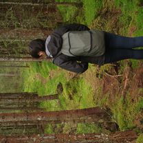
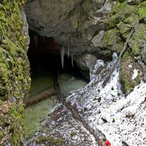
The first location is on the road by the lake towards Giurcuța de Sus. You can get here via the road that passes through Smida and heads to the lake. To cross private properties in front of the guesthouse, it is recommended to take the road towards Doda Pilii for a few hundred meters, then the road on the left towards the other households in the village. This road goes through the forest all the way to Giurcuța de Sus. After the last buildings, the blueberry patches appear in the forest and, depending on the season, you can find various mushrooms.
- -:--
- Duration
- 2.8 km
- Distance
- 35 m
- Ascent
- 55 m
- Descent
- ---
- Avg. speed
- ---
- Max. altitude

Route photos


Route highlights
Points of interest along the route

Point of interest after 1.8 km

Point of interest after 2 km
Continue with Bikemap
Use, edit, or download this cycling route
You would like to ride 17. Coada lacului Fântânele or customize it for your own trip? Here is what you can do with this Bikemap route:
Free features
- Save this route as favorite or in collections
- Copy & plan your own version of this route
- Sync your route with Garmin or Wahoo
Premium features
Free trial for 3 days, or one-time payment. More about Bikemap Premium.
- Navigate this route on iOS & Android
- Export a GPX / KML file of this route
- Create your custom printout (try it for free)
- Download this route for offline navigation
Discover more Premium features.
Get Bikemap PremiumFrom our community
Other popular routes starting in Beliş
 21. Poienița plantelor carnivore
- Distance
- 4.7 km
- Ascent
- 137 m
- Descent
- 137 m
- Location
- Beliş, Cluj County, Romania
 SUP session on Fântânele Lake, Beliș, Cluj Romania
- Distance
- 8 km
- Ascent
- 112 m
- Descent
- 100 m
- Location
- Beliş, Cluj County, Romania
 17. Coada lacului Fântânele
- Distance
- 2.8 km
- Ascent
- 35 m
- Descent
- 55 m
- Location
- Beliş, Cluj County, Romania
 Maraton MTB/XCM Turul Lacului Belis 2016. Traseu Scurt
- Distance
- 23.8 km
- Ascent
- 668 m
- Descent
- 668 m
- Location
- Beliş, Cluj County, Romania
 belis cascada valul miresei
- Distance
- 37.6 km
- Ascent
- 956 m
- Descent
- 860 m
- Location
- Beliş, Cluj County, Romania
 13. Cascada Răchițele (Vălul Miresei)
- Distance
- 23.3 km
- Ascent
- 551 m
- Descent
- 514 m
- Location
- Beliş, Cluj County, Romania
 3. Platoul Padiș
- Distance
- 101.3 km
- Ascent
- 1,670 m
- Descent
- 1,669 m
- Location
- Beliş, Cluj County, Romania
 8. Pe platoul Cârligate
- Distance
- 47.8 km
- Ascent
- 1,001 m
- Descent
- 998 m
- Location
- Beliş, Cluj County, Romania
Open it in the app