100-mile Siler City lunch
A cycling route starting in Green Level, North Carolina, United States.
Overview
About this route
- -:--
- Duration
- 153.2 km
- Distance
- 351 m
- Ascent
- 352 m
- Descent
- ---
- Avg. speed
- ---
- Max. altitude
Route quality
Waytypes & surfaces along the route
Waytypes
Road
67.4 km
(44 %)
Quiet road
56.7 km
(37 %)
Surfaces
Paved
68.9 km
(45 %)
Asphalt
62.8 km
(41 %)
Paved (undefined)
6.1 km
(4 %)
Undefined
84.2 km
(55 %)
Continue with Bikemap
Use, edit, or download this cycling route
You would like to ride 100-mile Siler City lunch or customize it for your own trip? Here is what you can do with this Bikemap route:
Free features
- Save this route as favorite or in collections
- Copy & plan your own version of this route
- Split it into stages to create a multi-day tour
- Sync your route with Garmin or Wahoo
Premium features
Free trial for 3 days, or one-time payment. More about Bikemap Premium.
- Navigate this route on iOS & Android
- Export a GPX / KML file of this route
- Create your custom printout (try it for free)
- Download this route for offline navigation
Discover more Premium features.
Get Bikemap PremiumFrom our community
Other popular routes starting in Green Level
- Roll'n on 20's.
- Distance
- 31.5 km
- Ascent
- 187 m
- Descent
- 186 m
- Location
- Green Level, North Carolina, United States
- Home - New Hope - Chatham
- Distance
- 35.1 km
- Ascent
- 153 m
- Descent
- 152 m
- Location
- Green Level, North Carolina, United States
- West Cary / Chatham
- Distance
- 71.5 km
- Ascent
- 200 m
- Descent
- 200 m
- Location
- Green Level, North Carolina, United States
- 100-mile Siler City lunch
- Distance
- 153.2 km
- Ascent
- 351 m
- Descent
- 352 m
- Location
- Green Level, North Carolina, United States
- 57-mile route around Jordan Lake, then dam and Tobacco trail
- Distance
- 99.1 km
- Ascent
- 383 m
- Descent
- 384 m
- Location
- Green Level, North Carolina, United States
- f1xedgear's commute route
- Distance
- 33.8 km
- Ascent
- 129 m
- Descent
- 145 m
- Location
- Green Level, North Carolina, United States
- 635 Finnbar Dr, Cary to 580–598 Finnbar Dr, Cary
- Distance
- 6.5 km
- Ascent
- 195 m
- Descent
- 190 m
- Location
- Green Level, North Carolina, United States
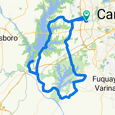
- 50ml route around Jordan Lake
- Distance
- 80.9 km
- Ascent
- 257 m
- Descent
- 256 m
- Location
- Green Level, North Carolina, United States
Open it in the app