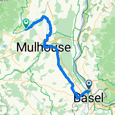
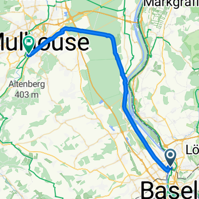
(01) Weil am Rhein - St.Hippolyte
- 98.1 km
- 1,105 m
- 954 m
- Weil am Rhein, Baden-Wurttemberg, Germany
A cycling route starting in Weil am Rhein, Baden-Wurttemberg, Germany.
Overview
From the train station in Weil am Rhein, cross the Passerelle des Trois Pays (bridge for pedestrians and cyclists) to St. Louis, then follow the main road until the turn towards Hegenheim. At the end of Hegenheim, take a turn and cross a hill on a partially gravel path. From Hagenthal, take little-trafficked country roads to Delle and continue uphill to Croix, through the gorge near Glan and steeply up to Chamesol. From here, enjoy a pleasant descent to the camping area in St.Hippolyte (restaurant/pizzeria in the village, as of June 2017, no grocery store!). First of twenty stages of a cycling tour around Switzerland. A relaxed start without significant challenges in a charming but unspectacular landscape.
created this 8 years ago
Route quality
Road
53 km
(54 %)
Quiet road
26.5 km
(27 %)
Paved
26.5 km
(27 %)
Asphalt
22.6 km
(23 %)
Paved (undefined)
2.9 km
(3 %)
Continue with Bikemap
You would like to ride (01) Weil am Rhein - St.Hippolyte or customize it for your own trip? Here is what you can do with this Bikemap route:
Free trial for 3 days, or one-time payment. More about Bikemap Premium.
Discover more Premium features.
Get Bikemap PremiumFrom our community
Open it in the app