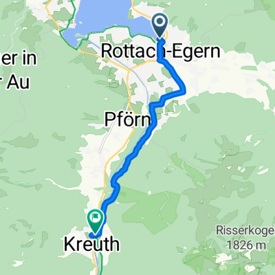


Auernalm, Tegernsee, Rottach-Egern
- 35.1 km
- 737 m
- 735 m
- Rottach-Egern, Bavaria, Germany
A cycling route starting in Rottach-Egern, Bavaria, Germany.
Overview
Endurance: Advanced
Riding skill: Beginner
Ride duration: 4 - 6 hours
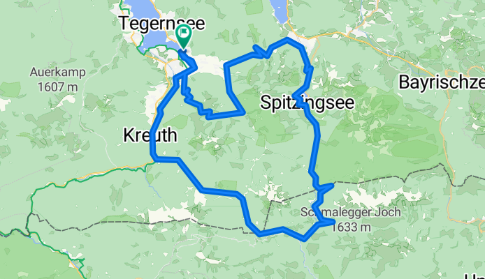
Break: Spitzingsee, various restaurants
The climbs up Wallberg and Kühzagel at the start of the tour are the toughest moments. Here, gradients are always >12% up to 18% with little chance for recovery (about 1000 meters elevation gain in total).
The ride from Spitzingsee along the 'roten Valepp' is on paved roads and goes quickly, with a pleasantly cool breeze even on hot days (in autumn it can be very cold).
At the end, turn left and follow the signs to EHJ Klause, then after the customs house head towards Bayenalm. Generally known as the Erzherzog-Johann loop.
After Bayenalm, you head home and your legs can relax all the way to the starting point in Rottach-Egern.
Conclusion
Interesting marathon route with varied nature, often along pretty mountain streams.
created this 8 years ago
Route quality
Track
52.4 km
(74 %)
Quiet road
11.3 km
(16 %)
Paved
17 km
(24 %)
Unpaved
48.9 km
(69 %)
Gravel
34 km
(48 %)
Asphalt
17 km
(24 %)
Route highlights
Schiebestrecke: 300m ca. 80hm bei +20%. Früher war hier nur ein malerischer kleiner Holzbalken um die Bairache zu queren. Heute ist hier ein High Tech Brücke. Selbst der "coole" Trail wurde planiert, damit Jeder das schafft.
Variaton mit extra Höhenmeter über den Setzberg.
Continue with Bikemap
You would like to ride Große Tegernsee Südrunde or customize it for your own trip? Here is what you can do with this Bikemap route:
Free trial for 3 days, or one-time payment. More about Bikemap Premium.
Discover more Premium features.
Get Bikemap PremiumFrom our community
Open it in the app