

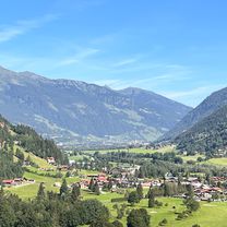
Overview
About this route
- -:--
- Duration
- 26.9 km
- Distance
- 1,238 m
- Ascent
- 1,238 m
- Descent
- ---
- Avg. speed
- ---
- Max. altitude

Part of
Gastein
3 stages
Route quality
Waytypes & surfaces along the route
Waytypes
Track
17.8 km
(66 %)
Quiet road
3.8 km
(14 %)
Surfaces
Paved
2.2 km
(8 %)
Unpaved
19.9 km
(74 %)
Gravel
18 km
(67 %)
Asphalt
2.1 km
(8 %)
Continue with Bikemap
Use, edit, or download this cycling route
You would like to ride Schlossalm or customize it for your own trip? Here is what you can do with this Bikemap route:
Free features
- Save this route as favorite or in collections
- Copy & plan your own version of this route
- Sync your route with Garmin or Wahoo
Premium features
Free trial for 3 days, or one-time payment. More about Bikemap Premium.
- Navigate this route on iOS & Android
- Export a GPX / KML file of this route
- Create your custom printout (try it for free)
- Download this route for offline navigation
Discover more Premium features.
Get Bikemap PremiumFrom our community
Other popular routes starting in Bad Hofgastein
 Alpe Adria III Bad Hofgastein - Spittal an der Drau
- Distance
- 67.4 km
- Ascent
- 1,189 m
- Descent
- 1,422 m
- Location
- Bad Hofgastein, Salzburg, Austria
 Gross Glockner Climb from Bad Hofgastein & The European Health Forum
- Distance
- 63.2 km
- Ascent
- 2,214 m
- Descent
- 501 m
- Location
- Bad Hofgastein, Salzburg, Austria
 urlaub 2021
- Distance
- 338.3 km
- Ascent
- 1,976 m
- Descent
- 2,240 m
- Location
- Bad Hofgastein, Salzburg, Austria
 Ri Possenhöhe
- Distance
- 12.5 km
- Ascent
- 538 m
- Descent
- 537 m
- Location
- Bad Hofgastein, Salzburg, Austria
 10 AL Bad Hofgastein-Stubnerkogel
- Distance
- 28 km
- Ascent
- 1,389 m
- Descent
- 1,387 m
- Location
- Bad Hofgastein, Salzburg, Austria
 Route In Gasteinertal
- Distance
- 20.9 km
- Ascent
- 541 m
- Descent
- 538 m
- Location
- Bad Hofgastein, Salzburg, Austria
 schlossalm
- Distance
- 7.7 km
- Ascent
- 937 m
- Descent
- 40 m
- Location
- Bad Hofgastein, Salzburg, Austria
 Am Griespark 13, Bad Hofgastein nach Hauptplatz 22, Spittal an der Drau
- Distance
- 73.1 km
- Ascent
- 848 m
- Descent
- 1,122 m
- Location
- Bad Hofgastein, Salzburg, Austria
Open it in the app