

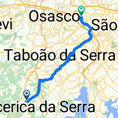
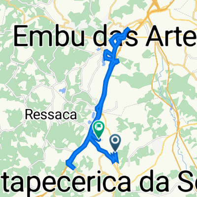
Trilha do Verde
A cycling route starting in Itapecerica da Serra, São Paulo, Brazil.
Overview
About this route
- -:--
- Duration
- 31.3 km
- Distance
- 446 m
- Ascent
- 446 m
- Descent
- ---
- Avg. speed
- ---
- Max. altitude

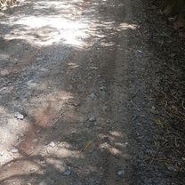
Route highlights
Points of interest along the route
Point of interest after 26.7 km
Corredeira do Morro Grande
Continue with Bikemap
Use, edit, or download this cycling route
You would like to ride Trilha do Verde or customize it for your own trip? Here is what you can do with this Bikemap route:
Free features
- Save this route as favorite or in collections
- Copy & plan your own version of this route
- Sync your route with Garmin or Wahoo
Premium features
Free trial for 3 days, or one-time payment. More about Bikemap Premium.
- Navigate this route on iOS & Android
- Export a GPX / KML file of this route
- Create your custom printout (try it for free)
- Download this route for offline navigation
Discover more Premium features.
Get Bikemap PremiumFrom our community
Other popular routes starting in Itapecerica da Serra
 pedal final de semana
- Distance
- 43.1 km
- Ascent
- 658 m
- Descent
- 653 m
- Location
- Itapecerica da Serra, São Paulo, Brazil
 Verde
Verde- Distance
- 31.6 km
- Ascent
- 411 m
- Descent
- 398 m
- Location
- Itapecerica da Serra, São Paulo, Brazil
 De Avenida José Joaquim dos Santos 58 a Avenida Imperatriz Leopoldina 915
- Distance
- 31.8 km
- Ascent
- 298 m
- Descent
- 401 m
- Location
- Itapecerica da Serra, São Paulo, Brazil
 De Avenida Quinze de Novembro 1583 a Rua Júlio Prestes de Albuquerque 371
- Distance
- 22.4 km
- Ascent
- 196 m
- Descent
- 229 m
- Location
- Itapecerica da Serra, São Paulo, Brazil
 Itapecerica - Embu-Guaçu (Kinkaku-ji/Mombaça)
- Distance
- 18 km
- Ascent
- 405 m
- Descent
- 522 m
- Location
- Itapecerica da Serra, São Paulo, Brazil
 Itap Serra Embu Guaçu
- Distance
- 29.8 km
- Ascent
- 201 m
- Descent
- 256 m
- Location
- Itapecerica da Serra, São Paulo, Brazil
 Itapecerica Lagoa Mombaça Kunkakuji
- Distance
- 24.8 km
- Ascent
- 707 m
- Descent
- 661 m
- Location
- Itapecerica da Serra, São Paulo, Brazil
 De Estrada Ary Domingues Mandu 553 a Estrada Ary Domingues Mandu 156
- Distance
- 15.3 km
- Ascent
- 342 m
- Descent
- 340 m
- Location
- Itapecerica da Serra, São Paulo, Brazil
Open it in the app