

Concediu 1030Km
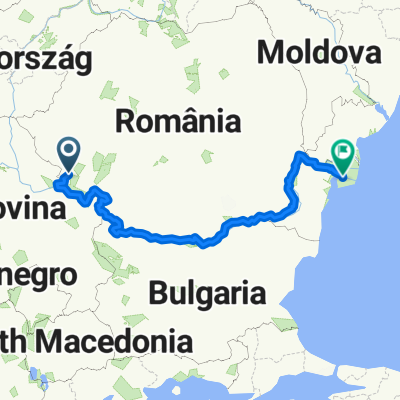
A cycling route starting in Oraviţa, Caraș-Severin County, Romania.
Overview
About this route
Concediu 1030Km diferente de altitudine de 10470m
- -:--
- Duration
- 1,029.8 km
- Distance
- 6,441 m
- Ascent
- 6,547 m
- Descent
- ---
- Avg. speed
- ---
- Max. altitude

Route quality
Waytypes & surfaces along the route
Waytypes
Busy road
675.6 km
(66 %)
Quiet road
158.9 km
(15 %)
Surfaces
Paved
791.6 km
(77 %)
Unpaved
140.2 km
(14 %)
Asphalt
782.4 km
(76 %)
Gravel
87.9 km
(9 %)
Continue with Bikemap
Use, edit, or download this cycling route
You would like to ride Concediu 1030Km or customize it for your own trip? Here is what you can do with this Bikemap route:
Free features
- Save this route as favorite or in collections
- Copy & plan your own version of this route
- Split it into stages to create a multi-day tour
- Sync your route with Garmin or Wahoo
Premium features
Free trial for 3 days, or one-time payment. More about Bikemap Premium.
- Navigate this route on iOS & Android
- Export a GPX / KML file of this route
- Create your custom printout (try it for free)
- Download this route for offline navigation
Discover more Premium features.
Get Bikemap PremiumFrom our community
Other popular routes starting in Oraviţa
 Cheile Nerei
- Distance
- 100.5 km
- Ascent
- 1,185 m
- Descent
- 1,184 m
- Location
- Oraviţa, Caraș-Severin County, Romania
 Oravita Beusnita -Oravita
- Distance
- 59.5 km
- Ascent
- 556 m
- Descent
- 553 m
- Location
- Oraviţa, Caraș-Severin County, Romania
 Clisura reloaded
- Distance
- 375.2 km
- Ascent
- 1,578 m
- Descent
- 1,578 m
- Location
- Oraviţa, Caraș-Severin County, Romania
 Concediu 1030Km
- Distance
- 1,029.8 km
- Ascent
- 6,441 m
- Descent
- 6,547 m
- Location
- Oraviţa, Caraș-Severin County, Romania
 Turul Dunarii - Team W - Group 3W
- Distance
- 550.9 km
- Ascent
- 2,425 m
- Descent
- 2,546 m
- Location
- Oraviţa, Caraș-Severin County, Romania
 Pe Dunăre de la Baziaș la Tulcea
- Distance
- 1,122.7 km
- Ascent
- 401 m
- Descent
- 607 m
- Location
- Oraviţa, Caraș-Severin County, Romania
 Turul Dunarii - Team W - Group 2W
- Distance
- 538.3 km
- Ascent
- 2,107 m
- Descent
- 2,239 m
- Location
- Oraviţa, Caraș-Severin County, Romania
 Danube route 2017 - day1
- Distance
- 91.9 km
- Ascent
- 357 m
- Descent
- 437 m
- Location
- Oraviţa, Caraș-Severin County, Romania
Open it in the app