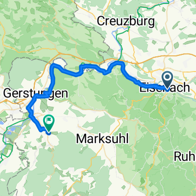
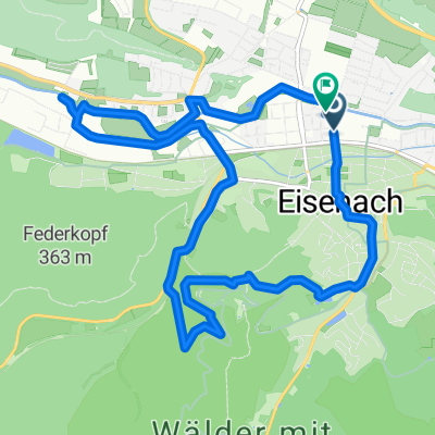
Thüringer Städtekette
A cycling route starting in Eisenach, Thuringia, Germany.
Overview
About this route
Ein phantastischer, gut ausgeschilderter Fernweg, der kulturell anregend mit schönen Städten und prächtigen Landschaften nicht geizt.
- -:--
- Duration
- 227.2 km
- Distance
- 673 m
- Ascent
- 682 m
- Descent
- ---
- Avg. speed
- ---
- Max. altitude
Route quality
Waytypes & surfaces along the route
Waytypes
Quiet road
74.3 km
(33 %)
Track
42.1 km
(19 %)
Surfaces
Paved
169.3 km
(74 %)
Unpaved
27.2 km
(12 %)
Asphalt
154.6 km
(68 %)
Gravel
19.6 km
(9 %)
Continue with Bikemap
Use, edit, or download this cycling route
You would like to ride Thüringer Städtekette or customize it for your own trip? Here is what you can do with this Bikemap route:
Free features
- Save this route as favorite or in collections
- Copy & plan your own version of this route
- Split it into stages to create a multi-day tour
- Sync your route with Garmin or Wahoo
Premium features
Free trial for 3 days, or one-time payment. More about Bikemap Premium.
- Navigate this route on iOS & Android
- Export a GPX / KML file of this route
- Create your custom printout (try it for free)
- Download this route for offline navigation
Discover more Premium features.
Get Bikemap PremiumFrom our community
Other popular routes starting in Eisenach
- Rund um den Hainich_t
- Distance
- 116.4 km
- Ascent
- 1,237 m
- Descent
- 1,239 m
- Location
- Eisenach, Thuringia, Germany
- Westroute Thüringer Wald
- Distance
- 96 km
- Ascent
- 1,150 m
- Descent
- 1,150 m
- Location
- Eisenach, Thuringia, Germany
- Trailschaukel Eisenach
- Distance
- 35.8 km
- Ascent
- 923 m
- Descent
- 923 m
- Location
- Eisenach, Thuringia, Germany
- kurze Tour
- Distance
- 17.3 km
- Ascent
- 213 m
- Descent
- 205 m
- Location
- Eisenach, Thuringia, Germany
- Eisenach-Gotha
- Distance
- 43.2 km
- Ascent
- 272 m
- Descent
- 190 m
- Location
- Eisenach, Thuringia, Germany
- 07.Wer.Eisen.-Philipst.
- Distance
- 195.8 km
- Ascent
- 2,079 m
- Descent
- 1,479 m
- Location
- Eisenach, Thuringia, Germany
- Goethestraße, Eisenach nach Planstraße, Amt Creuzburg
- Distance
- 26.1 km
- Ascent
- 394 m
- Descent
- 431 m
- Location
- Eisenach, Thuringia, Germany
- Zentraler Thüringer Wald
- Distance
- 99.9 km
- Ascent
- 1,260 m
- Descent
- 1,260 m
- Location
- Eisenach, Thuringia, Germany
Open it in the app