

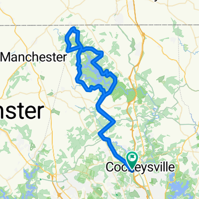
ride through Cockeysville
A cycling route starting in Cockeysville, Maryland, United States.
Overview
About this route
- -:--
- Duration
- 13.5 km
- Distance
- 221 m
- Ascent
- 220 m
- Descent
- ---
- Avg. speed
- ---
- Max. altitude

Route highlights
Points of interest along the route
Point of interest after 5.5 km
gnome
Point of interest after 5.5 km
deep washout
Point of interest after 5.8 km
bridges and built ups
Point of interest after 7.6 km
fire road
Point of interest after 9.3 km
ridge
Point of interest after 10.2 km
power lines field
Point of interest after 11.8 km
half pipe
Continue with Bikemap
Use, edit, or download this cycling route
You would like to ride ride through Cockeysville or customize it for your own trip? Here is what you can do with this Bikemap route:
Free features
- Save this route as favorite or in collections
- Copy & plan your own version of this route
- Sync your route with Garmin or Wahoo
Premium features
Free trial for 3 days, or one-time payment. More about Bikemap Premium.
- Navigate this route on iOS & Android
- Export a GPX / KML file of this route
- Create your custom printout (try it for free)
- Download this route for offline navigation
Discover more Premium features.
Get Bikemap PremiumFrom our community
Other popular routes starting in Cockeysville
 Quick bike tour through Cockeysville
- Distance
- 8 km
- Ascent
- 149 m
- Descent
- 146 m
- Location
- Cockeysville, Maryland, United States
 bike tour through Cockeysville
- Distance
- 11.1 km
- Ascent
- 181 m
- Descent
- 180 m
- Location
- Cockeysville, Maryland, United States
 oregen ridge park - dover rd
- Distance
- 20.1 km
- Ascent
- 215 m
- Descent
- 215 m
- Location
- Cockeysville, Maryland, United States
 Old Mill Road 13025, Cockeysville to Old Mill Road 13015, Cockeysville
- Distance
- 86.2 km
- Ascent
- 1,769 m
- Descent
- 1,768 m
- Location
- Cockeysville, Maryland, United States
 Stu Ride 2
- Distance
- 35.9 km
- Ascent
- 341 m
- Descent
- 388 m
- Location
- Cockeysville, Maryland, United States
 Test to Work
- Distance
- 6.1 km
- Ascent
- 42 m
- Descent
- 99 m
- Location
- Cockeysville, Maryland, United States
 ride through Cockeysville
- Distance
- 13.5 km
- Ascent
- 221 m
- Descent
- 220 m
- Location
- Cockeysville, Maryland, United States
 picnic 🦐🐻
- Distance
- 4 km
- Ascent
- 33 m
- Descent
- 26 m
- Location
- Cockeysville, Maryland, United States
Open it in the app