

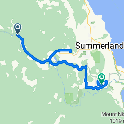
2017-07-02 Okanagan Trestle Tour
A cycling route starting in Summerland, British Columbia, Canada.
Overview
About this route
- -:--
- Duration
- 41.7 km
- Distance
- 57 m
- Ascent
- 902 m
- Descent
- ---
- Avg. speed
- ---
- Max. altitude
Route quality
Waytypes & surfaces along the route
Waytypes
Track
23.4 km
(56 %)
Cycleway
16.7 km
(40 %)
Surfaces
Paved
1.7 km
(4 %)
Unpaved
40.1 km
(96 %)
Gravel
38.8 km
(93 %)
Asphalt
1.7 km
(4 %)
Unpaved (undefined)
1.3 km
(3 %)
Route highlights
Points of interest along the route

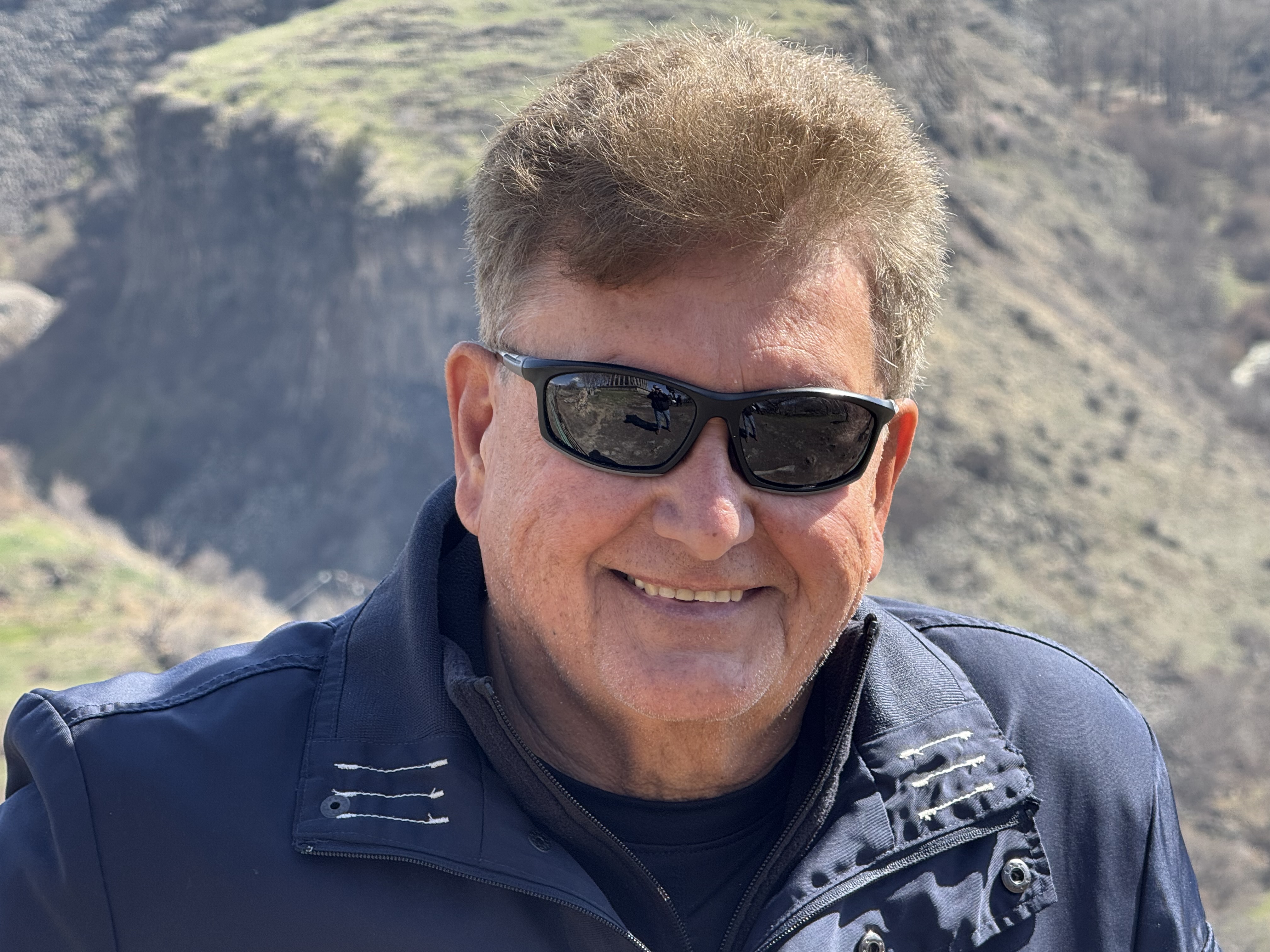
Photo after 24.2 km

Photo after 38.5 km
Continue with Bikemap
Use, edit, or download this cycling route
You would like to ride 2017-07-02 Okanagan Trestle Tour or customize it for your own trip? Here is what you can do with this Bikemap route:
Free features
- Save this route as favorite or in collections
- Copy & plan your own version of this route
- Sync your route with Garmin or Wahoo
Premium features
Free trial for 3 days, or one-time payment. More about Bikemap Premium.
- Navigate this route on iOS & Android
- Export a GPX / KML file of this route
- Create your custom printout (try it for free)
- Download this route for offline navigation
Discover more Premium features.
Get Bikemap PremiumFrom our community
Other popular routes starting in Summerland
 Summerland KVR TCT with notes
- Distance
- 21.2 km
- Ascent
- 291 m
- Descent
- 479 m
- Location
- Summerland, British Columbia, Canada
 KVR - Summerland to Hope
- Distance
- 250.4 km
- Ascent
- 1,095 m
- Descent
- 1,575 m
- Location
- Summerland, British Columbia, Canada
 12-09-14 Kanada: Chute Lake Resort (Kettle Valley Rail Trail)-Penticton
- Distance
- 39.6 km
- Ascent
- 19 m
- Descent
- 819 m
- Location
- Summerland, British Columbia, Canada
 N - L - Naramata Loop
- Distance
- 79.1 km
- Ascent
- 1,510 m
- Descent
- 1,510 m
- Location
- Summerland, British Columbia, Canada
 KVR - Glenfir - Penticton - OK Falls
- Distance
- 43.5 km
- Ascent
- 143 m
- Descent
- 607 m
- Location
- Summerland, British Columbia, Canada
 2017-07-02 Okanagan Trestle Tour
- Distance
- 41.7 km
- Ascent
- 57 m
- Descent
- 902 m
- Location
- Summerland, British Columbia, Canada
 N - S - Naramata Leg Warmer
- Distance
- 30.8 km
- Ascent
- 325 m
- Descent
- 325 m
- Location
- Summerland, British Columbia, Canada
 Chute Lake - Poplar Grove KVR
- Distance
- 39.1 km
- Ascent
- 71 m
- Descent
- 873 m
- Location
- Summerland, British Columbia, Canada
Open it in the app