

Sp.Brežnica-Pečica-Šmarje-Šentjur-Ponikva-Mlače-Poljčane
A cycling route starting in Poljčane, Občina Poljčane, Slovenia.
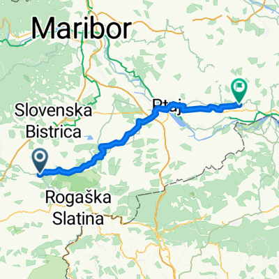
Overview
About this route
11.03.2011 Izredno lepa steza primerna za trening ali regeneracijsko vožnjo. Paziti na določene odseke, kjer je cesta v izredno slabem stanju. Je tudi precej prometna. Posebej izrazita je na odseku Ponikva-Mlače kjer skrene iz glavne ceste in pelje skozi gozd. Tu še posebno pozornost polagati posipanem pesku na asfaltni podlagi, ker je v gozdu sploh spomladi in poleti bujno zelenje in je slabša vidljivost.
- -:--
- Duration
- 52.7 km
- Distance
- 707 m
- Ascent
- 710 m
- Descent
- ---
- Avg. speed
- 381 m
- Max. altitude

Route quality
Waytypes & surfaces along the route
Waytypes
Quiet road
4.7 km
(9 %)
Cycleway
1.1 km
(2 %)
Surfaces
Paved
19.5 km
(37 %)
Asphalt
19.5 km
(37 %)
Undefined
33.2 km
(63 %)
Continue with Bikemap
Use, edit, or download this cycling route
You would like to ride Sp.Brežnica-Pečica-Šmarje-Šentjur-Ponikva-Mlače-Poljčane or customize it for your own trip? Here is what you can do with this Bikemap route:
Free features
- Save this route as favorite or in collections
- Copy & plan your own version of this route
- Sync your route with Garmin or Wahoo
Premium features
Free trial for 3 days, or one-time payment. More about Bikemap Premium.
- Navigate this route on iOS & Android
- Export a GPX / KML file of this route
- Create your custom printout (try it for free)
- Download this route for offline navigation
Discover more Premium features.
Get Bikemap PremiumFrom our community
Other popular routes starting in Poljčane
 STKP - Velikonočnica - Boč - Ljubična gora
- Distance
- 21.2 km
- Ascent
- 339 m
- Descent
- 339 m
- Location
- Poljčane, Občina Poljčane, Slovenia
 Loče - Ribniki Jernej - Lubicno - Loče
- Distance
- 17 km
- Ascent
- 368 m
- Descent
- 369 m
- Location
- Poljčane, Občina Poljčane, Slovenia
 Poljčane - Zavrč
- Distance
- 54.4 km
- Ascent
- 411 m
- Descent
- 470 m
- Location
- Poljčane, Občina Poljčane, Slovenia
 Tur po Sloveniji I
- Distance
- 355.2 km
- Ascent
- 3,896 m
- Descent
- 3,885 m
- Location
- Poljčane, Občina Poljčane, Slovenia
 krog do Maribora
- Distance
- 71.2 km
- Ascent
- 235 m
- Descent
- 232 m
- Location
- Poljčane, Občina Poljčane, Slovenia
 Okoli Boča
- Distance
- 23.1 km
- Ascent
- 932 m
- Descent
- 936 m
- Location
- Poljčane, Občina Poljčane, Slovenia
 okoli Boča s podaljškom do Podčetrtka
- Distance
- 76.9 km
- Ascent
- 363 m
- Descent
- 370 m
- Location
- Poljčane, Občina Poljčane, Slovenia
 čez Boč
- Distance
- 31.3 km
- Ascent
- 688 m
- Descent
- 691 m
- Location
- Poljčane, Občina Poljčane, Slovenia
Open it in the app