

ZEPPELIN2010_Colli Euganei Este
A cycling route starting in Monselice, Veneto, Italy.
Overview
About this route
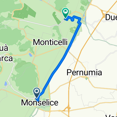
Meeting point at Monselice FS station, 09:30 AM.
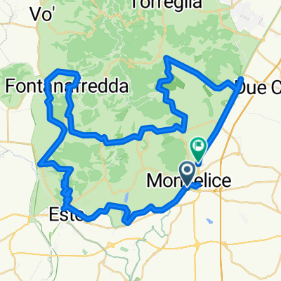
In the Euganean Hills Natural Park, along the easy cycle path that follows the historic Bisatto canal, passing first through the ancient medieval village of Este and then through the settlement of Lozzo Atestino, nestled at the foot of the mountain of the same name. Circular tour through vineyards and green fields.
- -:--
- Duration
- 61.4 km
- Distance
- 457 m
- Ascent
- 409 m
- Descent
- ---
- Avg. speed
- 164 m
- Max. altitude

Route quality
Waytypes & surfaces along the route
Waytypes
Quiet road
12.9 km
(21 %)
Road
1.2 km
(2 %)
Surfaces
Paved
55.2 km
(90 %)
Unpaved
2.5 km
(4 %)
Asphalt
54 km
(88 %)
Paved (undefined)
1.2 km
(2 %)
Route highlights
Points of interest along the route
Point of interest after 2.8 km
Stazione FS di Monselice, ore 09.30
Point of interest after 12.9 km
Este
Point of interest after 22 km
Lozzo Atestino
Point of interest after 42.9 km
Point of interest after 42.9 km
Point of interest after 44.8 km
Continue with Bikemap
Use, edit, or download this cycling route
You would like to ride ZEPPELIN2010_Colli Euganei Este or customize it for your own trip? Here is what you can do with this Bikemap route:
Free features
- Save this route as favorite or in collections
- Copy & plan your own version of this route
- Sync your route with Garmin or Wahoo
Premium features
Free trial for 3 days, or one-time payment. More about Bikemap Premium.
- Navigate this route on iOS & Android
- Export a GPX / KML file of this route
- Create your custom printout (try it for free)
- Download this route for offline navigation
Discover more Premium features.
Get Bikemap PremiumFrom our community
Other popular routes starting in Monselice
 Monselice - Ca Rocca Relais
- Distance
- 5.9 km
- Ascent
- 0 m
- Descent
- 5 m
- Location
- Monselice, Veneto, Italy
 Da Via Trento Trieste a Via F. Petrarca
- Distance
- 7.9 km
- Ascent
- 9 m
- Descent
- 16 m
- Location
- Monselice, Veneto, Italy
 PR Colli Euganei: Anello dei Colli Euganei_Anello dei Colli Euganei
- Distance
- 63.2 km
- Ascent
- 73 m
- Descent
- 75 m
- Location
- Monselice, Veneto, Italy
 Eos - Colli
- Distance
- 57.3 km
- Ascent
- 482 m
- Descent
- 489 m
- Location
- Monselice, Veneto, Italy
 Colli Euganei _Gruppo_Masi
- Distance
- 46.4 km
- Ascent
- 124 m
- Descent
- 125 m
- Location
- Monselice, Veneto, Italy
 ciclovia dei colli euganei
- Distance
- 78.2 km
- Ascent
- 396 m
- Descent
- 399 m
- Location
- Monselice, Veneto, Italy
 TAPPA 3: MONSELICE - ROVIGO
- Distance
- 32.1 km
- Ascent
- 13 m
- Descent
- 20 m
- Location
- Monselice, Veneto, Italy
 ZEPPELIN2010_Colli Euganei Este
- Distance
- 61.4 km
- Ascent
- 457 m
- Descent
- 409 m
- Location
- Monselice, Veneto, Italy
Open it in the app