

Radelparadies Nürnberger Land: Tour 1
A cycling route starting in Schnaittach, Bavaria, Germany.
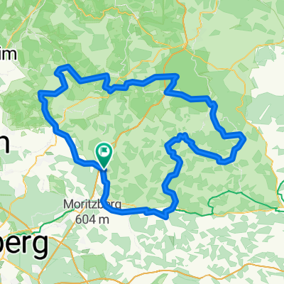
Overview
About this route
Beautiful views alternate with monotonous forest sections. Very poor signage (incomplete) in the Lauf area (07/2017).
- -:--
- Duration
- 40.4 km
- Distance
- 339 m
- Ascent
- 339 m
- Descent
- ---
- Avg. speed
- ---
- Max. altitude
Continue with Bikemap
Use, edit, or download this cycling route
You would like to ride Radelparadies Nürnberger Land: Tour 1 or customize it for your own trip? Here is what you can do with this Bikemap route:
Free features
- Save this route as favorite or in collections
- Copy & plan your own version of this route
- Sync your route with Garmin or Wahoo
Premium features
Free trial for 3 days, or one-time payment. More about Bikemap Premium.
- Navigate this route on iOS & Android
- Export a GPX / KML file of this route
- Create your custom printout (try it for free)
- Download this route for offline navigation
Discover more Premium features.
Get Bikemap PremiumFrom our community
Other popular routes starting in Schnaittach
 Radelparadies Nürnberger Land: Tour 1
- Distance
- 40.4 km
- Ascent
- 339 m
- Descent
- 339 m
- Location
- Schnaittach, Bavaria, Germany
 Frankenalp 3
- Distance
- 23.1 km
- Ascent
- 371 m
- Descent
- 364 m
- Location
- Schnaittach, Bavaria, Germany
 Quer Feld ein nach Spies
- Distance
- 22.8 km
- Ascent
- 334 m
- Descent
- 327 m
- Location
- Schnaittach, Bavaria, Germany
 20. Mittelfrankencup 2012 Ausfahrt 03 am 20.05.2012 in Schnaittach
- Distance
- 153 km
- Ascent
- 985 m
- Descent
- 985 m
- Location
- Schnaittach, Bavaria, Germany
 Sieglitzberger Runde
- Distance
- 36.4 km
- Ascent
- 659 m
- Descent
- 657 m
- Location
- Schnaittach, Bavaria, Germany
 MFC 2010, Teuferla's Tour rund um Schnaittach - Strecke 3
- Distance
- 123.3 km
- Ascent
- 658 m
- Descent
- 658 m
- Location
- Schnaittach, Bavaria, Germany
 W - Schnaittach-Lochhof
- Distance
- 4.8 km
- Ascent
- 111 m
- Descent
- 115 m
- Location
- Schnaittach, Bavaria, Germany
 Schnaittach-Vorra-Schnaittach
- Distance
- 39.6 km
- Ascent
- 785 m
- Descent
- 906 m
- Location
- Schnaittach, Bavaria, Germany
Open it in the app