

Overview
About this route
- -:--
- Duration
- 215.2 km
- Distance
- 77 m
- Ascent
- 78 m
- Descent
- ---
- Avg. speed
- ---
- Max. altitude

Part of
200
6 stages
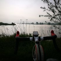
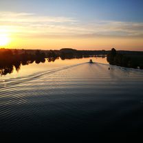
Route photos


Route quality
Waytypes & surfaces along the route
Waytypes
Quiet road
96.8 km
(45 %)
Road
58.1 km
(27 %)
Surfaces
Paved
116.2 km
(54 %)
Asphalt
116.2 km
(54 %)
Undefined
99 km
(46 %)
Continue with Bikemap
Use, edit, or download this cycling route
You would like to ride Rhein-Waal-Maas or customize it for your own trip? Here is what you can do with this Bikemap route:
Free features
- Save this route as favorite or in collections
- Copy & plan your own version of this route
- Split it into stages to create a multi-day tour
- Sync your route with Garmin or Wahoo
Premium features
Free trial for 3 days, or one-time payment. More about Bikemap Premium.
- Navigate this route on iOS & Android
- Export a GPX / KML file of this route
- Create your custom printout (try it for free)
- Download this route for offline navigation
Discover more Premium features.
Get Bikemap PremiumFrom our community
Other popular routes starting in Kevelaer
 Xanten-Öbermörmter-Uedem über Kirsel
- Distance
- 59.4 km
- Ascent
- 100 m
- Descent
- 103 m
- Location
- Kevelaer, North Rhine-Westphalia, Germany
 Arcen Faehre
- Distance
- 45.4 km
- Ascent
- 59 m
- Descent
- 57 m
- Location
- Kevelaer, North Rhine-Westphalia, Germany
 Schauen wir mal :-)
- Distance
- 157.7 km
- Ascent
- 99 m
- Descent
- 99 m
- Location
- Kevelaer, North Rhine-Westphalia, Germany
 Sonntagsrunde durch die holländischen Maasduinen
- Distance
- 61.2 km
- Ascent
- 80 m
- Descent
- 85 m
- Location
- Kevelaer, North Rhine-Westphalia, Germany
 Ich will "" MEER ""
- Distance
- 239.8 km
- Ascent
- 38 m
- Descent
- 61 m
- Location
- Kevelaer, North Rhine-Westphalia, Germany
 500 Km pures vergnügen
- Distance
- 482.5 km
- Ascent
- 175 m
- Descent
- 175 m
- Location
- Kevelaer, North Rhine-Westphalia, Germany
 Niederrhein Tour
- Distance
- 164.2 km
- Ascent
- 117 m
- Descent
- 117 m
- Location
- Kevelaer, North Rhine-Westphalia, Germany
 Photo Safari mit Mölle
- Distance
- 150.8 km
- Ascent
- 83 m
- Descent
- 86 m
- Location
- Kevelaer, North Rhine-Westphalia, Germany
Open it in the app