Numedal: Geilo - Rødberg - Kongsberg - Larvik
A cycling route starting in Geilo, Buskerud, Norway.
Overview
About this route
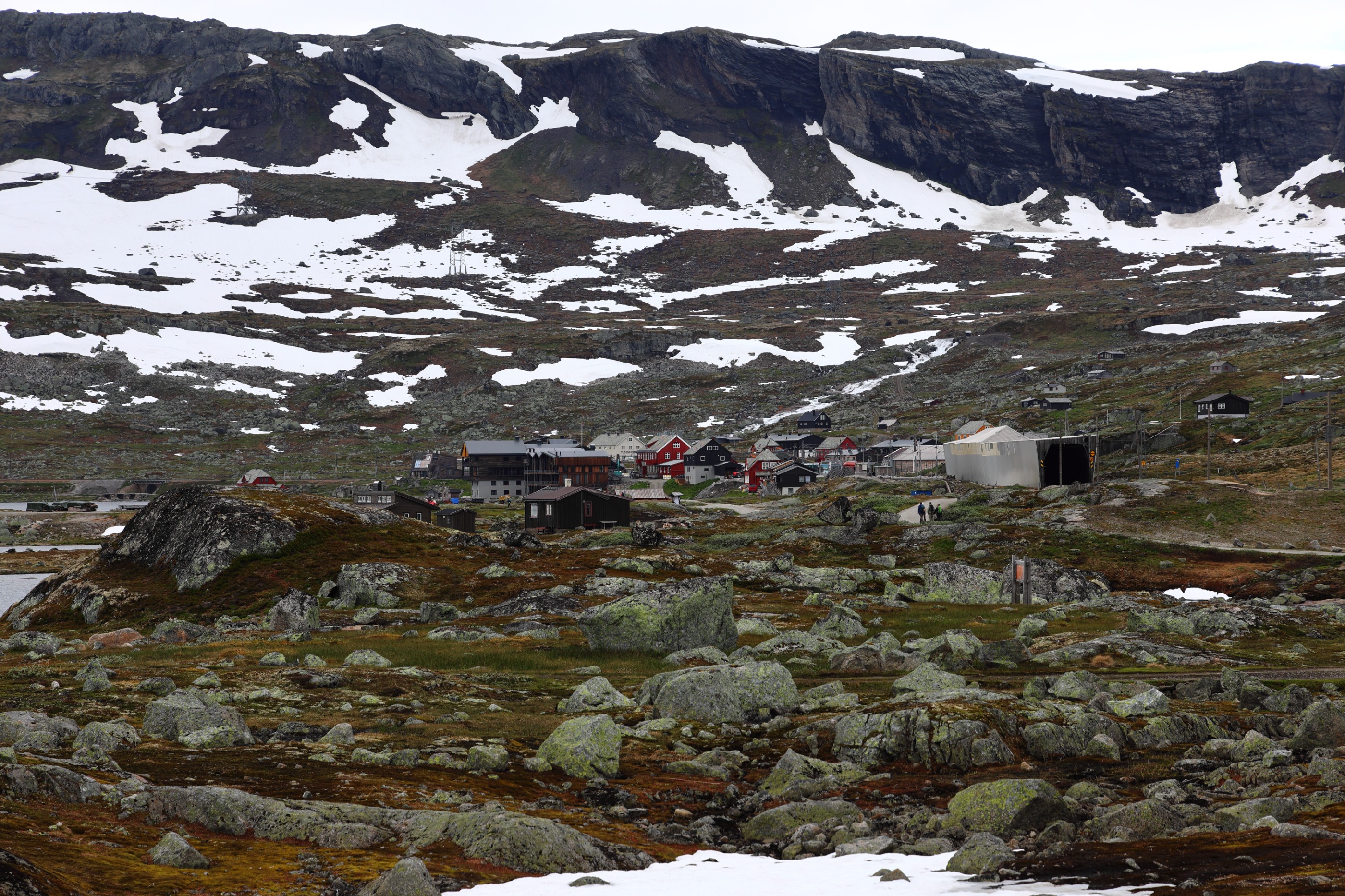
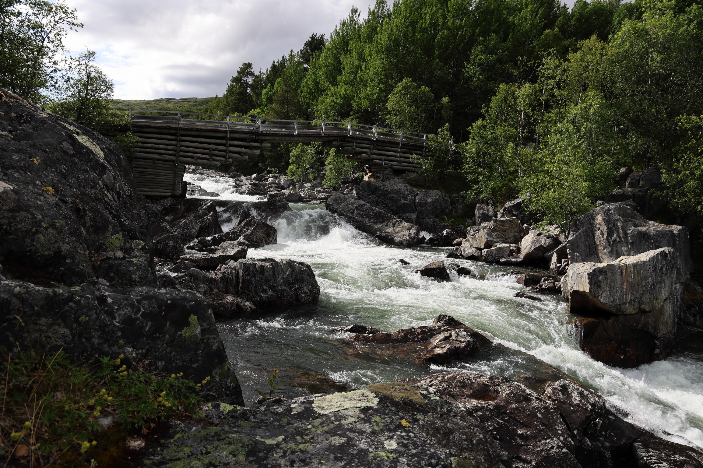
Sykkelruta går store deler av vegen langs Numedalslågen. Ruta går i et svært variert landskap fra høyfjell til hav. Det er for det meste lite trafikk langs vegen. Enkelte korte strekninger har grusdekke, ellers asfalt.
Spesielt barnevennlig er strekningene; Dagalifjell - Rødberg (43,5 km gjennom en vakker seterdal), Veggli - Rollag (16 km i flatt terreng langs solsvidde stuer og middelalderhus) og Brufoss - Larvik ( 57km langs Numedalslågen på lite trafikkerte veger).
ENGLISH:
For long stretches the Numedal trail follows the river Numedalslågen, other sections of the route run through ever changing landscapes from the tops of mountains down to the sea. Mostly the roads are quiet with little traffic. Some short stretches of the road have gravel surfaces, others asphalt. Family routes: Some routes are particularly suitable for children, Dagalifjell to Rødberg (43,5 km through beautiful summer dairy farming districts), Veggli - Rollag (16 km) is flat and runs past sun-drenched cabins and houses dating back to the Middle Ages. and Brufoss - Larvik (57 km along Numedalslågen on quiet roads with little traffic).
- -:--
- Duration
- 245.3 km
- Distance
- 1,513 m
- Ascent
- 2,284 m
- Descent
- ---
- Avg. speed
- ---
- Avg. speed
Route highlights
Points of interest along the route
Point of interest after 156.7 km
Lampeland Hotell. Tlf.: 32 76 09 00 Fax: 32 76 09 01 www.lampeland.no
Continue with Bikemap
Use, edit, or download this cycling route
You would like to ride Numedal: Geilo - Rødberg - Kongsberg - Larvik or customize it for your own trip? Here is what you can do with this Bikemap route:
Free features
- Save this route as favorite or in collections
- Copy & plan your own version of this route
- Split it into stages to create a multi-day tour
- Sync your route with Garmin or Wahoo
Premium features
Free trial for 3 days, or one-time payment. More about Bikemap Premium.
- Navigate this route on iOS & Android
- Export a GPX / KML file of this route
- Create your custom printout (try it for free)
- Download this route for offline navigation
Discover more Premium features.
Get Bikemap PremiumFrom our community
Other popular routes starting in Geilo
- Rallarvegen from Haugastol to Flåm
- Distance
- 78.3 km
- Ascent
- 2,045 m
- Descent
- 3,032 m
- Location
- Geilo, Buskerud, Norway
- norsko
- Distance
- 4,006.9 km
- Ascent
- 3,231 m
- Descent
- 4,215 m
- Location
- Geilo, Buskerud, Norway
- gelio oslo
- Distance
- 250.2 km
- Ascent
- 361 m
- Descent
- 345 m
- Location
- Geilo, Buskerud, Norway
- 3. etappe: Lia Fjellhotell til Sevletunet v/ Rødberg
- Distance
- 59.1 km
- Ascent
- 703 m
- Descent
- 1,251 m
- Location
- Geilo, Buskerud, Norway
- Rallarvegen: Haugastøl - Flåm
- Distance
- 74.1 km
- Ascent
- 2,119 m
- Descent
- 3,106 m
- Location
- Geilo, Buskerud, Norway
- itinerario 2 bis con ciclabili rallervagen trolltunga lisafjorden stavanger
- Distance
- 540.9 km
- Ascent
- 2,904 m
- Descent
- 3,883 m
- Location
- Geilo, Buskerud, Norway
- Rallarvegen 2000
- Distance
- 103.8 km
- Ascent
- 659 m
- Descent
- 1,430 m
- Location
- Geilo, Buskerud, Norway
- Rallarvegen: Haugastøl - Flåm
- Distance
- 77.4 km
- Ascent
- 1,800 m
- Descent
- 2,787 m
- Location
- Geilo, Buskerud, Norway
Open it in the app