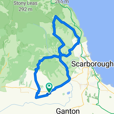
Lengthy ride from Scarborough to Bridlington
A cycling route starting in East Ayton, England, United Kingdom.
Overview
About this route
- -:--
- Duration
- 40.8 km
- Distance
- 408 m
- Ascent
- 440 m
- Descent
- ---
- Avg. speed
- ---
- Max. altitude
Route quality
Waytypes & surfaces along the route
Waytypes
Quiet road
11.4 km
(28 %)
Road
5.3 km
(13 %)
Surfaces
Paved
11 km
(27 %)
Asphalt
9.8 km
(24 %)
Paved (undefined)
1.2 km
(3 %)
Undefined
29.8 km
(73 %)
Route highlights
Points of interest along the route
Point of interest after 4.2 km
Continue with Bikemap
Use, edit, or download this cycling route
You would like to ride Lengthy ride from Scarborough to Bridlington or customize it for your own trip? Here is what you can do with this Bikemap route:
Free features
- Save this route as favorite or in collections
- Copy & plan your own version of this route
- Sync your route with Garmin or Wahoo
Premium features
Free trial for 3 days, or one-time payment. More about Bikemap Premium.
- Navigate this route on iOS & Android
- Export a GPX / KML file of this route
- Create your custom printout (try it for free)
- Download this route for offline navigation
Discover more Premium features.
Get Bikemap PremiumFrom our community
Other popular routes starting in East Ayton
- Tabular Hills Walk, Sawdon, Scarborough to Tabular Hills Walk, Sawdon, Scarborough
- Distance
- 21.7 km
- Ascent
- 356 m
- Descent
- 354 m
- Location
- East Ayton, England, United Kingdom
- Lengthy ride from Scarborough to Bridlington
- Distance
- 40.8 km
- Ascent
- 408 m
- Descent
- 440 m
- Location
- East Ayton, England, United Kingdom
- Beginner route
- Distance
- 11.5 km
- Ascent
- 178 m
- Descent
- 101 m
- Location
- East Ayton, England, United Kingdom
- Staintondale and Hayburn wyke
- Distance
- 63.6 km
- Ascent
- 679 m
- Descent
- 672 m
- Location
- East Ayton, England, United Kingdom
- Cockrah Road, Scarborough to Mowthorp Road, Scarborough
- Distance
- 5.8 km
- Ascent
- 65 m
- Descent
- 63 m
- Location
- East Ayton, England, United Kingdom
- Yorks1
- Distance
- 75.3 km
- Ascent
- 473 m
- Descent
- 452 m
- Location
- East Ayton, England, United Kingdom
- (Purposed) Mencap Moor To Sea Bike Trail.
- Distance
- 26.4 km
- Ascent
- 314 m
- Descent
- 352 m
- Location
- East Ayton, England, United Kingdom
- Beginner 2
- Distance
- 11 km
- Ascent
- ---
- Descent
- ---
- Location
- East Ayton, England, United Kingdom
Open it in the app