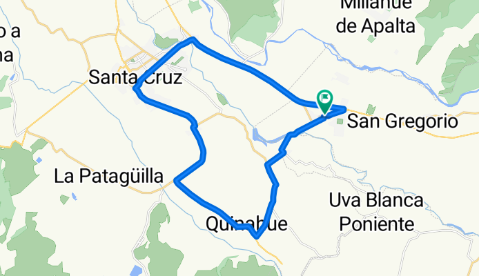
Circuito 2, Cunaco-Chomedahue-Sta Cruz-Cunaco
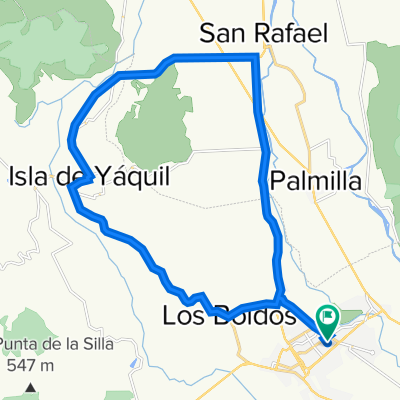
A cycling route starting in Santa Cruz, O'Higgins Region, Chile.
Overview
About this route
- 37 h 32 min
- Duration
- 25.1 km
- Distance
- 30 m
- Ascent
- 30 m
- Descent
- 0.7 km/h
- Avg. speed
- ---
- Max. altitude
Route quality
Waytypes & surfaces along the route
Waytypes
Busy road
22.3 km
(89 %)
Cycleway
1.4 km
(5 %)
Surfaces
Paved
22.6 km
(90 %)
Asphalt
20.2 km
(80 %)
Paved (undefined)
1.6 km
(6 %)
Continue with Bikemap
Use, edit, or download this cycling route
You would like to ride Circuito 2, Cunaco-Chomedahue-Sta Cruz-Cunaco or customize it for your own trip? Here is what you can do with this Bikemap route:
Free features
- Save this route as favorite or in collections
- Copy & plan your own version of this route
- Sync your route with Garmin or Wahoo
Premium features
Free trial for 3 days, or one-time payment. More about Bikemap Premium.
- Navigate this route on iOS & Android
- Export a GPX / KML file of this route
- Create your custom printout (try it for free)
- Download this route for offline navigation
Discover more Premium features.
Get Bikemap PremiumFrom our community
Other popular routes starting in Santa Cruz
- tranque millahue
- Distance
- 17.7 km
- Ascent
- 692 m
- Descent
- 686 m
- Location
- Santa Cruz, O'Higgins Region, Chile
- DESAFIO EXTREMO LAS CORTADERAS CLONED FROM ROUTE 1261764
- Distance
- 84.9 km
- Ascent
- 1,615 m
- Descent
- 1,615 m
- Location
- Santa Cruz, O'Higgins Region, Chile
- Las cortaderas- Isla de Yaquil
- Distance
- 51.8 km
- Ascent
- 906 m
- Descent
- 905 m
- Location
- Santa Cruz, O'Higgins Region, Chile
- De Calle 1 1229, Santa Cruz a Calle 1 1229, Santa Cruz
- Distance
- 23.6 km
- Ascent
- 184 m
- Descent
- 183 m
- Location
- Santa Cruz, O'Higgins Region, Chile
- De Domeyko 116, Santa Cruz a 21 de Mayo 1467–1539, Santa Cruz
- Distance
- 23.8 km
- Ascent
- 43 m
- Descent
- 44 m
- Location
- Santa Cruz, O'Higgins Region, Chile
- Santa Cruz Circuito
- Distance
- 65.9 km
- Ascent
- 371 m
- Descent
- 354 m
- Location
- Santa Cruz, O'Higgins Region, Chile
- chepica
- Distance
- 30.1 km
- Ascent
- 88 m
- Descent
- 105 m
- Location
- Santa Cruz, O'Higgins Region, Chile
- Circuito 2, Cunaco-Chomedahue-Sta Cruz-Cunaco
- Distance
- 25.1 km
- Ascent
- 30 m
- Descent
- 30 m
- Location
- Santa Cruz, O'Higgins Region, Chile
Open it in the app