

Saint Jean la Rivière 69.2250
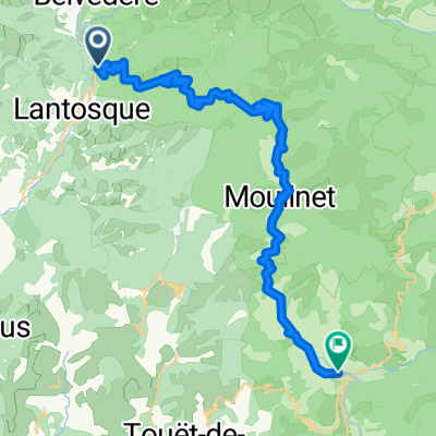
A cycling route starting in Lantosque, Provence-Alpes-Côte d'Azur Region, France.
Overview
About this route
Circuit with a highlight at Tete d'Albéras
- -:--
- Duration
- 68.8 km
- Distance
- 2,126 m
- Ascent
- 2,127 m
- Descent
- ---
- Avg. speed
- ---
- Max. altitude

Route quality
Waytypes & surfaces along the route
Waytypes
Quiet road
22 km
(32 %)
Road
21.3 km
(31 %)
Surfaces
Paved
0.7 km
(1 %)
Unpaved
8.9 km
(13 %)
Gravel
8.9 km
(13 %)
Asphalt
0.7 km
(1 %)
Undefined
59.2 km
(86 %)
Continue with Bikemap
Use, edit, or download this cycling route
You would like to ride Saint Jean la Rivière 69.2250 or customize it for your own trip? Here is what you can do with this Bikemap route:
Free features
- Save this route as favorite or in collections
- Copy & plan your own version of this route
- Sync your route with Garmin or Wahoo
Premium features
Free trial for 3 days, or one-time payment. More about Bikemap Premium.
- Navigate this route on iOS & Android
- Export a GPX / KML file of this route
- Create your custom printout (try it for free)
- Download this route for offline navigation
Discover more Premium features.
Get Bikemap PremiumFrom our community
Other popular routes starting in Lantosque
 Turini
- Distance
- 66.1 km
- Ascent
- 1,803 m
- Descent
- 1,804 m
- Location
- Lantosque, Provence-Alpes-Côte d'Azur Region, France
 Saint Jean la Rivière 69.2250
- Distance
- 68.8 km
- Ascent
- 2,126 m
- Descent
- 2,127 m
- Location
- Lantosque, Provence-Alpes-Côte d'Azur Region, France
 Col de Turini
- Distance
- 38.8 km
- Ascent
- 1,249 m
- Descent
- 1,386 m
- Location
- Lantosque, Provence-Alpes-Côte d'Azur Region, France
 Tête de Siruol
- Distance
- 28.2 km
- Ascent
- 1,516 m
- Descent
- 1,587 m
- Location
- Lantosque, Provence-Alpes-Côte d'Azur Region, France
 Madone, Turini
- Distance
- 145.8 km
- Ascent
- 3,244 m
- Descent
- 3,304 m
- Location
- Lantosque, Provence-Alpes-Côte d'Azur Region, France
 D 68, La Bollène-Vésubie to 49 Avenue Cyrille Besset, Nice
- Distance
- 55.2 km
- Ascent
- 1,715 m
- Descent
- 3,283 m
- Location
- Lantosque, Provence-Alpes-Côte d'Azur Region, France
 La Reynald
- Distance
- 77.7 km
- Ascent
- 2,574 m
- Descent
- 2,027 m
- Location
- Lantosque, Provence-Alpes-Côte d'Azur Region, France
 France Transalp Etappe9
- Distance
- 83.3 km
- Ascent
- 3,135 m
- Descent
- 3,421 m
- Location
- Lantosque, Provence-Alpes-Côte d'Azur Region, France
Open it in the app