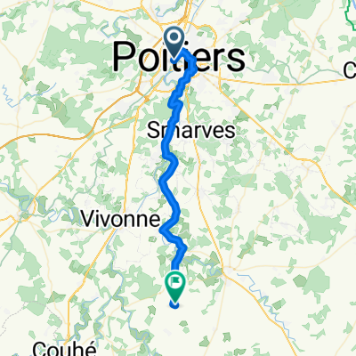
Tour de France: Poitiers - Mont des Alouettes
- 158.8 km
- 646 m
- 531 m
- Poitiers, Nouvelle-Aquitaine, France
A cycling route starting in Poitiers, Nouvelle-Aquitaine, France.
Overview
Puy Lose (cat. 4)
Mont Mercure (cat. 4)
Puy du Fou (cat. 3)
Mont des Alouettes (cat. 4)
created this 8 years ago
Route quality
Road
58.8 km
(37 %)
Quiet road
19.1 km
(12 %)
Paved
27 km
(17 %)
Asphalt
27 km
(17 %)
Undefined
131.8 km
(83 %)
Continue with Bikemap
You would like to ride Tour de France: Poitiers - Mont des Alouettes or customize it for your own trip? Here is what you can do with this Bikemap route:
Free trial for 3 days, or one-time payment. More about Bikemap Premium.
Discover more Premium features.
Get Bikemap PremiumFrom our community
Open it in the app