- 61.5 km
- 878 m
- 876 m
- Kirchheim unter Teck, Baden-Wurttemberg, Germany
Aichelberg Feierabendrunde
A cycling route starting in Kirchheim unter Teck, Baden-Wurttemberg, Germany.
Overview
About this route
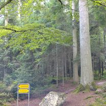
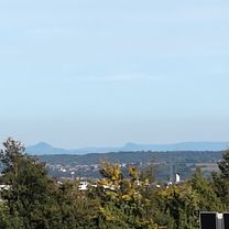
Lockere Runde bis Zell, Aufstieg in Eckwälden, unterhalb des Deutschen Hauses wir es ein kleiner Trail. Danach Schotterpiste bis Häringen und abermals ein kleiner Trail bis Wanderparkplatz Weilheim
- -:--
- Duration
- 33.4 km
- Distance
- 409 m
- Ascent
- 414 m
- Descent
- ---
- Avg. speed
- ---
- Max. altitude
stoppelrocker
created this 8 years ago
Route quality
Waytypes & surfaces along the route
Waytypes
Track
23 km
(69 %)
Quiet road
5.3 km
(16 %)
Surfaces
Paved
13.4 km
(40 %)
Unpaved
16 km
(48 %)
Gravel
10 km
(30 %)
Paved (undefined)
7 km
(21 %)
Continue with Bikemap
Use, edit, or download this cycling route
You would like to ride Aichelberg Feierabendrunde or customize it for your own trip? Here is what you can do with this Bikemap route:
Free features
- Save this route as favorite or in collections
- Copy & plan your own version of this route
- Sync your route with Garmin or Wahoo
Premium features
Free trial for 3 days, or one-time payment. More about Bikemap Premium.
- Navigate this route on iOS & Android
- Export a GPX / KML file of this route
- Create your custom printout (try it for free)
- Download this route for offline navigation
Discover more Premium features.
Get Bikemap PremiumFrom our community
Other popular routes starting in Kirchheim unter Teck
- Albtraufmarathon 2009 Mitteldistanz CLONED FROM ROUTE 314364
- Route von Kirchheim unter Teck
- 20.9 km
- 294 m
- 223 m
- Kirchheim unter Teck, Baden-Wurttemberg, Germany
- Max-Eyth-Straße nach Friedrich-Münch-Weg
- 85.9 km
- 1,226 m
- 833 m
- Kirchheim unter Teck, Baden-Wurttemberg, Germany
- Route in Kirchheim unter Teck
- 60.1 km
- 1,349 m
- 1,347 m
- Kirchheim unter Teck, Baden-Wurttemberg, Germany
- Von S-Bahn KT nach S-Bahn FL
- 47.9 km
- 748 m
- 687 m
- Kirchheim unter Teck, Baden-Wurttemberg, Germany
- Kirchheim-Aichelberg-Neidlingen-Nabern
- 29.4 km
- 272 m
- 213 m
- Kirchheim unter Teck, Baden-Wurttemberg, Germany
- Schöner Teckweg
- 20 km
- 437 m
- 439 m
- Kirchheim unter Teck, Baden-Wurttemberg, Germany
- Kirchheim - Meistern, Sommenhardt
- 96.3 km
- 1,422 m
- 1,020 m
- Kirchheim unter Teck, Baden-Wurttemberg, Germany
Open it in the app


