Pfad des Gedenkens
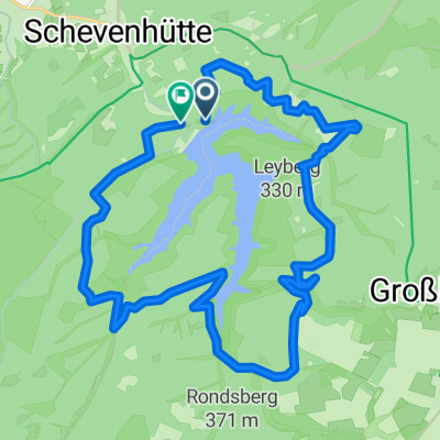
A cycling route starting in Hürtgenwald, North Rhine-Westphalia, Germany.
Overview
About this route
TAHUNA track
- -:--
- Duration
- 9.7 km
- Distance
- 324 m
- Ascent
- 324 m
- Descent
- ---
- Avg. speed
- ---
- Avg. speed
Route quality
Waytypes & surfaces along the route
Waytypes
Track
5.1 km
(52 %)
Quiet road
1.4 km
(14 %)
Surfaces
Paved
3 km
(31 %)
Unpaved
4.7 km
(48 %)
Gravel
2.3 km
(24 %)
Ground
2.1 km
(22 %)
Continue with Bikemap
Use, edit, or download this cycling route
You would like to ride Pfad des Gedenkens or customize it for your own trip? Here is what you can do with this Bikemap route:
Free features
- Save this route as favorite or in collections
- Copy & plan your own version of this route
- Sync your route with Garmin or Wahoo
Premium features
Free trial for 3 days, or one-time payment. More about Bikemap Premium.
- Navigate this route on iOS & Android
- Export a GPX / KML file of this route
- Create your custom printout (try it for free)
- Download this route for offline navigation
Discover more Premium features.
Get Bikemap PremiumFrom our community
Other popular routes starting in Hürtgenwald
- Offroad rund um die Talsperre
- Distance
- 23.2 km
- Ascent
- 457 m
- Descent
- 550 m
- Location
- Hürtgenwald, North Rhine-Westphalia, Germany
- Mittler Tour Kalltalsperre
- Distance
- 31.6 km
- Ascent
- 445 m
- Descent
- 445 m
- Location
- Hürtgenwald, North Rhine-Westphalia, Germany
- Wehetal-Nideggen
- Distance
- 51.9 km
- Ascent
- 819 m
- Descent
- 819 m
- Location
- Hürtgenwald, North Rhine-Westphalia, Germany
- Wehebachtalsperre
- Distance
- 21.4 km
- Ascent
- 371 m
- Descent
- 371 m
- Location
- Hürtgenwald, North Rhine-Westphalia, Germany
- Kleinhau - Hƶhenschneise - 17-Kurven-Weg
- Distance
- 29.3 km
- Ascent
- 353 m
- Descent
- 356 m
- Location
- Hürtgenwald, North Rhine-Westphalia, Germany
- MUDbikers 45K Wehebachtalsperre Mausbach
- Distance
- 45.1 km
- Ascent
- 609 m
- Descent
- 609 m
- Location
- Hürtgenwald, North Rhine-Westphalia, Germany
- Hotel Kallbach Rundfahrt 30km mit Restaurant
- Distance
- 29.5 km
- Ascent
- 564 m
- Descent
- 569 m
- Location
- Hürtgenwald, North Rhine-Westphalia, Germany
- Stef@n in 3 Tagen nach Hoorn 2006
- Distance
- 444 km
- Ascent
- 73 m
- Descent
- 455 m
- Location
- Hürtgenwald, North Rhine-Westphalia, Germany
Open it in the app