

2009 Oder-Neiße-Spree
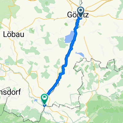
09/10 Görlitz - Kottmar über Zittau
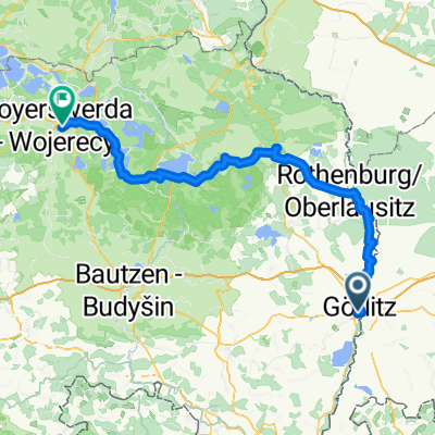
A cycling route starting in Zgorzelec, Lower Silesian Voivodeship, Poland.
Overview
About this route
Day 10 of the 2009 cycling holiday
Initially flat on good bike paths, then hilly, typical of the Lusatian Highlands. On the way to Kottmar, we even had to push the bike at times. Beautiful scenery, lunch at Maiental Monastery.
Self-measured 61 km
- -:--
- Duration
- 59.2 km
- Distance
- 392 m
- Ascent
- 292 m
- Descent
- ---
- Avg. speed
- 317 m
- Max. altitude

Part of
13 stages
Route quality
Waytypes & surfaces along the route
Waytypes
Quiet road
14.8 km
(25 %)
Cycleway
11.3 km
(19 %)
Surfaces
Paved
39.1 km
(66 %)
Unpaved
4.1 km
(7 %)
Asphalt
37.9 km
(64 %)
Unpaved (undefined)
2.4 km
(4 %)
Continue with Bikemap
Use, edit, or download this cycling route
You would like to ride 09/10 Görlitz - Kottmar über Zittau or customize it for your own trip? Here is what you can do with this Bikemap route:
Free features
- Save this route as favorite or in collections
- Copy & plan your own version of this route
- Sync your route with Garmin or Wahoo
Premium features
Free trial for 3 days, or one-time payment. More about Bikemap Premium.
- Navigate this route on iOS & Android
- Export a GPX / KML file of this route
- Create your custom printout (try it for free)
- Download this route for offline navigation
Discover more Premium features.
Get Bikemap PremiumFrom our community
Other popular routes starting in Zgorzelec
 Nysa-Odra Zgorzelec-Świnoujście
- Distance
- 493.9 km
- Ascent
- 170 m
- Descent
- 377 m
- Location
- Zgorzelec, Lower Silesian Voivodeship, Poland
 Pieńsk i przez Niemcy
- Distance
- 30.7 km
- Ascent
- 123 m
- Descent
- 123 m
- Location
- Zgorzelec, Lower Silesian Voivodeship, Poland
 rondo im Jakoba Böhme, Zgorzelec do Kopaczów
- Distance
- 43.1 km
- Ascent
- 314 m
- Descent
- 287 m
- Location
- Zgorzelec, Lower Silesian Voivodeship, Poland
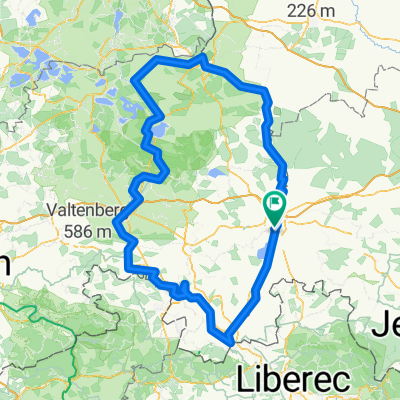 Der Zwillingsradweg
- Distance
- 274.9 km
- Ascent
- 1,386 m
- Descent
- 1,386 m
- Location
- Zgorzelec, Lower Silesian Voivodeship, Poland
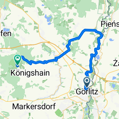 Von Görlitz bis Königshain
- Distance
- 29.9 km
- Ascent
- 350 m
- Descent
- 263 m
- Location
- Zgorzelec, Lower Silesian Voivodeship, Poland
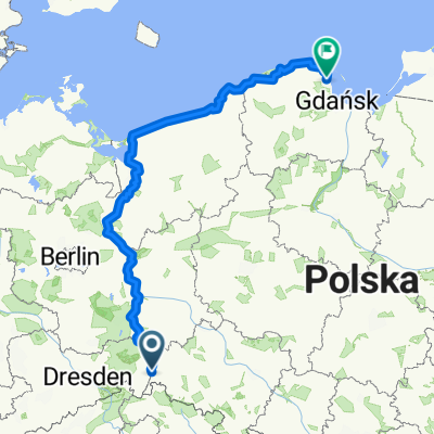 From Zgorzelec to Kosakowo
- Distance
- 839 km
- Ascent
- 2,871 m
- Descent
- 3,081 m
- Location
- Zgorzelec, Lower Silesian Voivodeship, Poland
 Sybiraków 15, Zgorzelec do Łużycka 33, Zgorzelec
- Distance
- 20.6 km
- Ascent
- 16 m
- Descent
- 33 m
- Location
- Zgorzelec, Lower Silesian Voivodeship, Poland
 Görlitz - Hoyerswerda 08.08.2025
- Distance
- 105.9 km
- Ascent
- 685 m
- Descent
- 810 m
- Location
- Zgorzelec, Lower Silesian Voivodeship, Poland
Open it in the app