

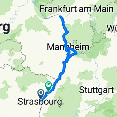
Véloroute Alsace début
A cycling route starting in Hœnheim, Grand Est, France.
Overview
About this route
- -:--
- Duration
- 139.3 km
- Distance
- 141 m
- Ascent
- 33 m
- Descent
- ---
- Avg. speed
- ---
- Max. altitude

Route quality
Waytypes & surfaces along the route
Waytypes
Track
51.1 km
(37 %)
Cycleway
28.8 km
(21 %)
Surfaces
Paved
69.1 km
(50 %)
Unpaved
52 km
(37 %)
Asphalt
65.8 km
(47 %)
Gravel
43.5 km
(31 %)
Continue with Bikemap
Use, edit, or download this cycling route
You would like to ride Véloroute Alsace début or customize it for your own trip? Here is what you can do with this Bikemap route:
Free features
- Save this route as favorite or in collections
- Copy & plan your own version of this route
- Split it into stages to create a multi-day tour
- Sync your route with Garmin or Wahoo
Premium features
Free trial for 3 days, or one-time payment. More about Bikemap Premium.
- Navigate this route on iOS & Android
- Export a GPX / KML file of this route
- Create your custom printout (try it for free)
- Download this route for offline navigation
Discover more Premium features.
Get Bikemap PremiumFrom our community
Other popular routes starting in Hœnheim
 2 Route de Bischwiller, Souffelweyersheim à 11A Rue de l'Aigle, Bischheim
- Distance
- 32.1 km
- Ascent
- 91 m
- Descent
- 91 m
- Location
- Hœnheim, Grand Est, France
 Itinéraire à partir de 4 Rue du Canal, Hoenheim
- Distance
- 517.1 km
- Ascent
- 4,022 m
- Descent
- 4,025 m
- Location
- Hœnheim, Grand Est, France
 3. EuroVelo 5 Strasbourg - Chatenois
- Distance
- 84.3 km
- Ascent
- 550 m
- Descent
- 490 m
- Location
- Hœnheim, Grand Est, France
 Véloroute Alsace début
- Distance
- 139.3 km
- Ascent
- 141 m
- Descent
- 33 m
- Location
- Hœnheim, Grand Est, France
 Straßburg Bantzenheim
- Distance
- 100.4 km
- Ascent
- 86 m
- Descent
- 10 m
- Location
- Hœnheim, Grand Est, France
 sortie A-M
- Distance
- 80 km
- Ascent
- 264 m
- Descent
- 262 m
- Location
- Hœnheim, Grand Est, France
 gettin' fit for 55
- Distance
- 2,831.5 km
- Ascent
- 5,294 m
- Descent
- 5,427 m
- Location
- Hœnheim, Grand Est, France
 Route de l'Hôpital, Straßburg nach Quintinsstraße, Mainz
- Distance
- 451.1 km
- Ascent
- 1,253 m
- Descent
- 1,265 m
- Location
- Hœnheim, Grand Est, France
Open it in the app