

Dolomity2017
A cycling route starting in Gries am Brenner, Tyrol, Austria.
Overview
About this route
Vylet do Dolomit
-
Brennero - Wurzjoch - La Villa (Badia)
-
Sella Ronda
-
La Villa - rif. Fanes - Cortina
-
Cortina - sella Ciampigotto - Ravascletto
-
Ravascletto - strada Monte Crostis - rif. O. Marinelli
-
rif. Marinelli - Passo di Monte Croce Carnico (Plöckenpass) - Lienz - Bad Gastein
-
Bad Gastein - Dienten am Hochkonig - Lofer - Kossen - Bernau am Chiemsee
- -:--
- Duration
- 709 km
- Distance
- 8,853 m
- Ascent
- 9,706 m
- Descent
- ---
- Avg. speed
- ---
- Max. altitude
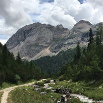
Route photos

Route highlights
Points of interest along the route

Photo after 62.7 km

Photo after 72 km

Photo after 78 km

Photo after 82.8 km

Photo after 92.1 km

Photo after 116.4 km

Photo after 120.5 km

Photo after 123.1 km
Arabba

Photo after 133.3 km

Photo after 135.8 km

Photo after 137.7 km

Photo after 148.4 km

Photo after 159.8 km

Photo after 162.9 km
Point of interest after 178.9 km
Nocleh 1 Nocleh 2

Photo after 193.7 km
San Martin

Photo after 212.3 km

Photo after 214.9 km

Photo after 216.4 km

Photo after 220 km

Photo after 221.8 km

Photo after 222.2 km
Passo del Limo

Photo after 222.8 km

Photo after 225.4 km

Photo after 228.4 km

Photo after 235.2 km

Photo after 236.8 km
Point of interest after 256.7 km
Nocleh 3

Photo after 261.9 km

Photo after 268 km
passo Cimabanche, 1530m

Photo after 309.5 km

Photo after 314 km
Santa Margherita (chiesa, XIII s)

Photo after 325.4 km

Photo after 336.7 km

Photo after 360.7 km
Prato Carnico
Point of interest after 376 km
Nocleh 4

Photo after 387.6 km

Photo after 391.5 km

Photo after 393.5 km

Photo after 407.8 km

Photo after 414.1 km

Photo after 425.1 km

Photo after 432.7 km

Point of interest after 433.9 km
Nocleh 5

Photo after 435.3 km

Photo after 446.5 km

Photo after 526.9 km
Point of interest after 553.7 km
Nocleh 6

Photo after 578.7 km
Point of interest after 675.5 km
Nocleh 0
Point of interest after 701.3 km
Nocleh 7

Photo after 701.6 km
Continue with Bikemap
Use, edit, or download this cycling route
You would like to ride Dolomity2017 or customize it for your own trip? Here is what you can do with this Bikemap route:
Free features
- Save this route as favorite or in collections
- Copy & plan your own version of this route
- Split it into stages to create a multi-day tour
- Sync your route with Garmin or Wahoo
Premium features
Free trial for 3 days, or one-time payment. More about Bikemap Premium.
- Navigate this route on iOS & Android
- Export a GPX / KML file of this route
- Create your custom printout (try it for free)
- Download this route for offline navigation
Discover more Premium features.
Get Bikemap PremiumFrom our community
Other popular routes starting in Gries am Brenner
 20210922_66km-1590hm
- Distance
- 66.1 km
- Ascent
- 1,919 m
- Descent
- 2,327 m
- Location
- Gries am Brenner, Tyrol, Austria
 Brenner-Kollmann
- Distance
- 75.1 km
- Ascent
- 755 m
- Descent
- 1,646 m
- Location
- Gries am Brenner, Tyrol, Austria
 2010.1-Dolomitentour Brennerpass - Bruneck
- Distance
- 79.2 km
- Ascent
- 415 m
- Descent
- 960 m
- Location
- Gries am Brenner, Tyrol, Austria
 Brennero - Trento
- Distance
- 164.4 km
- Ascent
- 1,300 m
- Descent
- 2,472 m
- Location
- Gries am Brenner, Tyrol, Austria
 Brenner - Venedig
- Distance
- 330.5 km
- Ascent
- 882 m
- Descent
- 2,258 m
- Location
- Gries am Brenner, Tyrol, Austria
 Dolomiten per Train + Bike
- Distance
- 332.8 km
- Ascent
- 1,302 m
- Descent
- 2,485 m
- Location
- Gries am Brenner, Tyrol, Austria
 Route 99 - Brenner Bozen - 1. Teil
- Distance
- 99 km
- Ascent
- 78 m
- Descent
- 1,221 m
- Location
- Gries am Brenner, Tyrol, Austria
 Dolomity2017
- Distance
- 709 km
- Ascent
- 8,853 m
- Descent
- 9,706 m
- Location
- Gries am Brenner, Tyrol, Austria
Open it in the app