Alpencross 2010 | Etappe 6
A cycling route starting in Martell, Trentino-Alto Adige, Italy.
Overview
About this route
St.Gertraud – Rabbijoch – Rabbi – Passo Cercen – Fucine / Ossana
Von Sankt Nicolaus fahre ich auf der Asphaltstrasse bis Sankt Gertraud. Ab hier geht’s wieder auf Schotterstrasse am Anfang moderat später sehr steil bis kurz unters Rabbijoch wo eine kurze Schiebstrecke ansteht und weiter zur Haselgruber Hütte. Übrigens ist die Haselgruber Hütte sehr empfehlenswert auch zum Nächtigen.<br /> Die Abfahrt von der Haselgruberhütte ist anspruchsvoll, sehr steil und sandig. Von Rabbi bis Male geht’s auf der Asphaltstrasse weiter. Von Male einfach den Radweg nach Folgarida und weiter bis zum Rifugio Graffer.<br />
- -:--
- Duration
- 44.5 km
- Distance
- 2,473 m
- Ascent
- 2,924 m
- Descent
- ---
- Avg. speed
- ---
- Avg. speed
Route highlights
Points of interest along the route
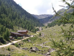
Photo after 9.3 km
Rabbijoch
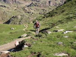
Photo after 9.7 km
Rabbijoch

Photo after 9.8 km
Rabbijoch
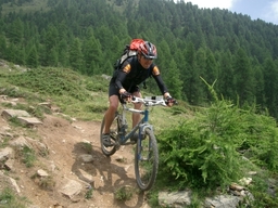
Photo after 9.9 km
Rabbijoch

Photo after 9.9 km
Rabbijoch
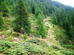
Photo after 10 km
Rabbijoch

Photo after 30.4 km
Passo Cercen
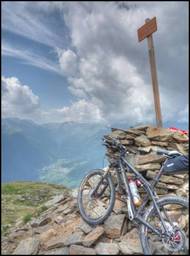
Photo after 30.6 km
Passo Cercen
Continue with Bikemap
Use, edit, or download this cycling route
You would like to ride Alpencross 2010 | Etappe 6 or customize it for your own trip? Here is what you can do with this Bikemap route:
Free features
- Save this route as favorite or in collections
- Copy & plan your own version of this route
- Sync your route with Garmin or Wahoo
Premium features
Free trial for 3 days, or one-time payment. More about Bikemap Premium.
- Navigate this route on iOS & Android
- Export a GPX / KML file of this route
- Create your custom printout (try it for free)
- Download this route for offline navigation
Discover more Premium features.
Get Bikemap PremiumFrom our community
Other popular routes starting in Martell
 Sausewind - V2
- Distance
- 50.3 km
- Ascent
- 190 m
- Descent
- 1,781 m
- Location
- Martell, Trentino-Alto Adige, Italy
 3000er Alpencross2011 Teil3
- Distance
- 64.1 km
- Ascent
- 2,344 m
- Descent
- 1,542 m
- Location
- Martell, Trentino-Alto Adige, Italy
 tttttt
- Distance
- 11.5 km
- Ascent
- 1,351 m
- Descent
- 1,351 m
- Location
- Martell, Trentino-Alto Adige, Italy
 Da Frazione Ganda 39 a Via Stazione 2, Lasa
- Distance
- 20.1 km
- Ascent
- 285 m
- Descent
- 691 m
- Location
- Martell, Trentino-Alto Adige, Italy
 Peder-Stier-Alm - Kalvenwand
- Distance
- 8.5 km
- Ascent
- 878 m
- Descent
- 878 m
- Location
- Martell, Trentino-Alto Adige, Italy
 Giro #6/2 Val Martello - St. Moritz
- Distance
- 131.7 km
- Ascent
- 1,932 m
- Descent
- 2,191 m
- Location
- Martell, Trentino-Alto Adige, Italy
 Martello - Passo dello Stelvio - Martello
- Distance
- 119.6 km
- Ascent
- 2,717 m
- Descent
- 2,716 m
- Location
- Martell, Trentino-Alto Adige, Italy
 Zufallhütte-Latscheralm 32km/1110 HM
- Distance
- 31.9 km
- Ascent
- 1,246 m
- Descent
- 1,714 m
- Location
- Martell, Trentino-Alto Adige, Italy
Open it in the app


