

Tankumsee und zurück
A cycling route starting in Königslutter am Elm, Lower Saxony, Germany.
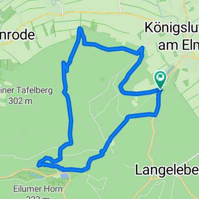
Overview
About this route
Königslutter Station - Tankumsee and back
Outward: through the Fuhren to Riseberg (great); beyond Rieseberg, 5 minutes of tall grass, nettles and a single-track path (bearable); then a lovely mix of farm tracks, cycle paths and a bit of tarmac roads. The Beienroder and Hahnstedter Holz forest sections are really first class!
Through the Barnbruch (just before the lake I went straight – dreadful! (tall grass, not even a beaten path), only the cross path was okay, hence the detour through Ilkerbruch settlement (that should be right – but I can't promise)
Return: Along the canal (great); from Edesbüttel to Allerbüttel (cycle path – good); The main road section from Allerbüttel to Essenrode (dreadful); then to Wohld (all super, great mix); from Wohld to Bornum again mainly main road (I took the side ways – dreadful!); then nice and easy back to Königslutter. :)
- 4 h 42 min
- Duration
- 75.1 km
- Distance
- 195 m
- Ascent
- 195 m
- Descent
- 15.9 km/h
- Avg. speed
- ---
- Max. altitude

Route quality
Waytypes & surfaces along the route
Waytypes
Track
37.5 km
(50 %)
Quiet road
10.5 km
(14 %)
Surfaces
Paved
33.8 km
(45 %)
Unpaved
33 km
(44 %)
Asphalt
30 km
(40 %)
Gravel
15 km
(20 %)
Continue with Bikemap
Use, edit, or download this cycling route
You would like to ride Tankumsee und zurück or customize it for your own trip? Here is what you can do with this Bikemap route:
Free features
- Save this route as favorite or in collections
- Copy & plan your own version of this route
- Sync your route with Garmin or Wahoo
Premium features
Free trial for 3 days, or one-time payment. More about Bikemap Premium.
- Navigate this route on iOS & Android
- Export a GPX / KML file of this route
- Create your custom printout (try it for free)
- Download this route for offline navigation
Discover more Premium features.
Get Bikemap PremiumFrom our community
Other popular routes starting in Königslutter am Elm
 5. Königslutter - Schöningen - BM
- Distance
- 43 km
- Ascent
- 285 m
- Descent
- 268 m
- Location
- Königslutter am Elm, Lower Saxony, Germany
 ELM TOUR MAGIC
- Distance
- 55.2 km
- Ascent
- 449 m
- Descent
- 449 m
- Location
- Königslutter am Elm, Lower Saxony, Germany
 Elm M05 (Eilumer Horn)
- Distance
- 22.6 km
- Ascent
- 375 m
- Descent
- 279 m
- Location
- Königslutter am Elm, Lower Saxony, Germany
 Kletterpartie Elm
- Distance
- 38.7 km
- Ascent
- 369 m
- Descent
- 412 m
- Location
- Königslutter am Elm, Lower Saxony, Germany
 königslutter-lehre-königslutter
- Distance
- 50.1 km
- Ascent
- 150 m
- Descent
- 162 m
- Location
- Königslutter am Elm, Lower Saxony, Germany
 sobota
- Distance
- 18.4 km
- Ascent
- 400 m
- Descent
- 398 m
- Location
- Königslutter am Elm, Lower Saxony, Germany
 Sonntagmorgenbrötchenholen
- Distance
- 10.5 km
- Ascent
- 113 m
- Descent
- 112 m
- Location
- Königslutter am Elm, Lower Saxony, Germany
 Elmrunde 06.19
- Distance
- 23.1 km
- Ascent
- 423 m
- Descent
- 413 m
- Location
- Königslutter am Elm, Lower Saxony, Germany
Open it in the app