

2017_E12_Chécy_Montlouis-sur-Loire
A cycling route starting in Chécy, Centre-Val de Loire, France.
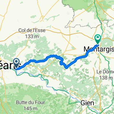
Overview
About this route
Tour de Bourgogne
Trip: 130,5Km réels
Odo: 1198Km
- -:--
- Duration
- 149.3 km
- Distance
- 147 m
- Ascent
- 194 m
- Descent
- ---
- Avg. speed
- ---
- Max. altitude

Route quality
Waytypes & surfaces along the route
Waytypes
Quiet road
58.2 km
(39 %)
Cycleway
23.9 km
(16 %)
Surfaces
Paved
49.3 km
(33 %)
Unpaved
26.9 km
(18 %)
Asphalt
44.8 km
(30 %)
Gravel
14.9 km
(10 %)
Continue with Bikemap
Use, edit, or download this cycling route
You would like to ride 2017_E12_Chécy_Montlouis-sur-Loire or customize it for your own trip? Here is what you can do with this Bikemap route:
Free features
- Save this route as favorite or in collections
- Copy & plan your own version of this route
- Split it into stages to create a multi-day tour
- Sync your route with Garmin or Wahoo
Premium features
Free trial for 3 days, or one-time payment. More about Bikemap Premium.
- Navigate this route on iOS & Android
- Export a GPX / KML file of this route
- Create your custom printout (try it for free)
- Download this route for offline navigation
Discover more Premium features.
Get Bikemap PremiumFrom our community
Other popular routes starting in Chécy
 Von Chécy bis Châlette-sur-Loing
- Distance
- 70.2 km
- Ascent
- 135 m
- Descent
- 149 m
- Location
- Chécy, Centre-Val de Loire, France
 Chécy Christian / Nançay
- Distance
- 74.5 km
- Ascent
- 299 m
- Descent
- 275 m
- Location
- Chécy, Centre-Val de Loire, France
 Chartres-Pouilly sur Loire
- Distance
- 129.2 km
- Ascent
- 156 m
- Descent
- 102 m
- Location
- Chécy, Centre-Val de Loire, France
 Jour 2 new
- Distance
- 71.3 km
- Ascent
- 129 m
- Descent
- 99 m
- Location
- Chécy, Centre-Val de Loire, France
 saint etienne sur usson
- Distance
- 371.5 km
- Ascent
- 989 m
- Descent
- 306 m
- Location
- Chécy, Centre-Val de Loire, France
 35 Rue du Petit Bourgneuf, Chécy à 68 Rue de Boisgault, Donnery
- Distance
- 8.8 km
- Ascent
- 45 m
- Descent
- 40 m
- Location
- Chécy, Centre-Val de Loire, France
 De Rue du Bailli Groslot, Saint-Denis-en-Val à Rue des Chevreuils, Saint-Denis-en-Val
- Distance
- 1.1 km
- Ascent
- 0 m
- Descent
- 0 m
- Location
- Chécy, Centre-Val de Loire, France
 E 28: Chemin du Port 35, Chécy nach Le Lac de Loire 5, Vineuil
- Distance
- 71.4 km
- Ascent
- 152 m
- Descent
- 176 m
- Location
- Chécy, Centre-Val de Loire, France
Open it in the app