

Attersee-Golling
A cycling route starting in Attersee, Upper Austria, Austria.
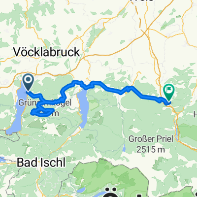
Overview
About this route
Alexenau-Weißenbach-BadIschl-PassGschütt-Golling
- -:--
- Duration
- 86.2 km
- Distance
- 635 m
- Ascent
- 643 m
- Descent
- ---
- Avg. speed
- ---
- Max. altitude

Route quality
Waytypes & surfaces along the route
Waytypes
Busy road
65.5 km
(76 %)
Road
10 km
(12 %)
Surfaces
Paved
80.9 km
(94 %)
Unpaved
1.7 km
(2 %)
Asphalt
80.8 km
(94 %)
Gravel
1.5 km
(2 %)
Continue with Bikemap
Use, edit, or download this cycling route
You would like to ride Attersee-Golling or customize it for your own trip? Here is what you can do with this Bikemap route:
Free features
- Save this route as favorite or in collections
- Copy & plan your own version of this route
- Split it into stages to create a multi-day tour
- Sync your route with Garmin or Wahoo
Premium features
Free trial for 3 days, or one-time payment. More about Bikemap Premium.
- Navigate this route on iOS & Android
- Export a GPX / KML file of this route
- Create your custom printout (try it for free)
- Download this route for offline navigation
Discover more Premium features.
Get Bikemap PremiumFrom our community
Other popular routes starting in Attersee
 Attersee
- Distance
- 49.1 km
- Ascent
- 737 m
- Descent
- 734 m
- Location
- Attersee, Upper Austria, Austria
 Legends 2017 Tag 1 - Variante 2
- Distance
- 113.3 km
- Ascent
- 403 m
- Descent
- 410 m
- Location
- Attersee, Upper Austria, Austria
 B152 31, Weyregg am Attersee nach B152 31, Weyregg am Attersee
- Distance
- 33.3 km
- Ascent
- 875 m
- Descent
- 865 m
- Location
- Attersee, Upper Austria, Austria
 Attersee-Kronberg-Lichtenberg-Attersee
- Distance
- 32.9 km
- Ascent
- 912 m
- Descent
- 859 m
- Location
- Attersee, Upper Austria, Austria
 attersee
- Distance
- 46.6 km
- Ascent
- 202 m
- Descent
- 202 m
- Location
- Attersee, Upper Austria, Austria
 Attersee és Mondsee
- Distance
- 81.3 km
- Ascent
- 411 m
- Descent
- 411 m
- Location
- Attersee, Upper Austria, Austria
 2025_08_19_Weyregg-Reindlmühle-Micheldorf
- Distance
- 89.6 km
- Ascent
- 2,559 m
- Descent
- 2,576 m
- Location
- Attersee, Upper Austria, Austria
 Attersee-Oberwang-Mondsee
- Distance
- 74.4 km
- Ascent
- 1,224 m
- Descent
- 1,221 m
- Location
- Attersee, Upper Austria, Austria
Open it in the app