

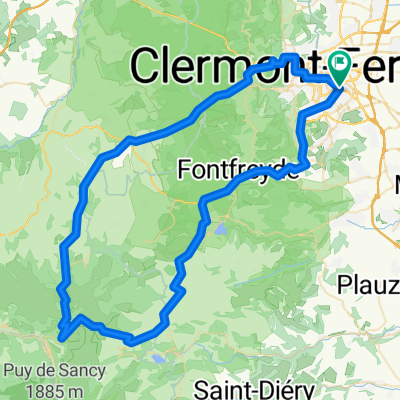
AUVERGNE - BRM 200 Clermont Ferrand
A cycling route starting in Aubière, Auvergne-Rhône-Alpes, France.
Overview
About this route
2.5 km missing on the route, straight line instead of the planned path (software glitch...). Beautiful route leading to the beginning of the upper Allier, with its magnificent villages and wild landscapes.
- -:--
- Duration
- 188.5 km
- Distance
- 1,467 m
- Ascent
- 1,442 m
- Descent
- ---
- Avg. speed
- 741 m
- Max. altitude

Route quality
Waytypes & surfaces along the route
Waytypes
Quiet road
39.6 km
(21 %)
Road
32.1 km
(17 %)
Surfaces
Paved
69.8 km
(37 %)
Unpaved
1.9 km
(1 %)
Asphalt
67.9 km
(36 %)
Paved (undefined)
1.9 km
(1 %)
Continue with Bikemap
Use, edit, or download this cycling route
You would like to ride AUVERGNE - BRM 200 Clermont Ferrand or customize it for your own trip? Here is what you can do with this Bikemap route:
Free features
- Save this route as favorite or in collections
- Copy & plan your own version of this route
- Split it into stages to create a multi-day tour
- Sync your route with Garmin or Wahoo
Premium features
Free trial for 3 days, or one-time payment. More about Bikemap Premium.
- Navigate this route on iOS & Android
- Export a GPX / KML file of this route
- Create your custom printout (try it for free)
- Download this route for offline navigation
Discover more Premium features.
Get Bikemap PremiumFrom our community
Other popular routes starting in Aubière
 De Boulevard Gustave Flaubert 9, Clermont-Ferrand à Boulevard du Président J Fitzgerald Kennedy 10, Vichy
- Distance
- 69.6 km
- Ascent
- 178 m
- Descent
- 309 m
- Location
- Aubière, Auvergne-Rhône-Alpes, France
 De Allée Traversière 30, Clermont-Ferrand à Allée Traversière 30, Clermont-Ferrand
- Distance
- 31 km
- Ascent
- 399 m
- Descent
- 400 m
- Location
- Aubière, Auvergne-Rhône-Alpes, France
 France Ultime : Clermont-Ferrand - Montignac
- Distance
- 211.9 km
- Ascent
- 1,149 m
- Descent
- 1,434 m
- Location
- Aubière, Auvergne-Rhône-Alpes, France
 Boucle Mont Dore 120km 2500m
- Distance
- 121.4 km
- Ascent
- 1,995 m
- Descent
- 1,997 m
- Location
- Aubière, Auvergne-Rhône-Alpes, France
 Lockdown friendly (1km radius)
- Distance
- 4.1 km
- Ascent
- 37 m
- Descent
- 34 m
- Location
- Aubière, Auvergne-Rhône-Alpes, France
 Aubière/Gergovie/Aydat/Aubière
- Distance
- 53.3 km
- Ascent
- 997 m
- Descent
- 997 m
- Location
- Aubière, Auvergne-Rhône-Alpes, France
 fdb st hippo
- Distance
- 28.7 km
- Ascent
- 210 m
- Descent
- 108 m
- Location
- Aubière, Auvergne-Rhône-Alpes, France
 Cf-Col de la croix morand
- Distance
- 87.6 km
- Ascent
- 1,517 m
- Descent
- 1,516 m
- Location
- Aubière, Auvergne-Rhône-Alpes, France
Open it in the app