

Overview
About this route
TAHUNA track
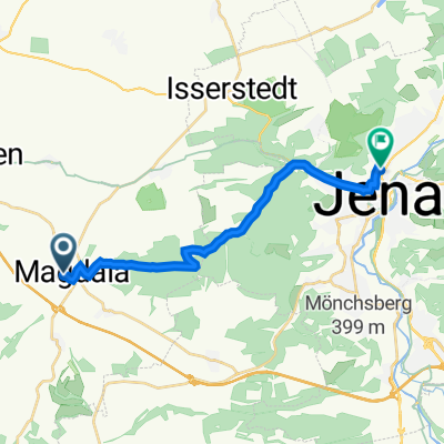
Saale-Tour Tag 5: von Weimar an Ilm und Magdel über Rudolstadt an der Saale nach Jena (Teil 2)
- -:--
- Duration
- 80.2 km
- Distance
- 340 m
- Ascent
- 471 m
- Descent
- ---
- Avg. speed
- ---
- Max. altitude

Part of
Saaletour 2017
12 stages
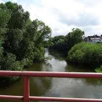
Route photos


Route quality
Waytypes & surfaces along the route
Waytypes
Quiet road
20.9 km
(26 %)
Track
13.6 km
(17 %)
Surfaces
Paved
62.6 km
(78 %)
Unpaved
5.6 km
(7 %)
Asphalt
61.8 km
(77 %)
Gravel
2.4 km
(3 %)
Continue with Bikemap
Use, edit, or download this cycling route
You would like to ride 20170717_100640.gpx or customize it for your own trip? Here is what you can do with this Bikemap route:
Free features
- Save this route as favorite or in collections
- Copy & plan your own version of this route
- Split it into stages to create a multi-day tour
- Sync your route with Garmin or Wahoo
Premium features
Free trial for 3 days, or one-time payment. More about Bikemap Premium.
- Navigate this route on iOS & Android
- Export a GPX / KML file of this route
- Create your custom printout (try it for free)
- Download this route for offline navigation
Discover more Premium features.
Get Bikemap PremiumFrom our community
Other popular routes starting in Magdala
 Route zu Steigerwald Stadium
- Distance
- 40.9 km
- Ascent
- 182 m
- Descent
- 246 m
- Location
- Magdala, Thuringia, Germany
 20170717_100640.gpx
- Distance
- 80.2 km
- Ascent
- 340 m
- Descent
- 471 m
- Location
- Magdala, Thuringia, Germany
 Döbritschen/Vesser
- Distance
- 86.1 km
- Ascent
- 810 m
- Descent
- 508 m
- Location
- Magdala, Thuringia, Germany
 M nach Schuhgasse, PN, Radweg
- Distance
- 36.8 km
- Ascent
- 594 m
- Descent
- 652 m
- Location
- Magdala, Thuringia, Germany
 Ottstedter Straße, Magdala nach Dornburger Straße 26, Jena
- Distance
- 14.5 km
- Ascent
- 387 m
- Descent
- 526 m
- Location
- Magdala, Thuringia, Germany
 Johannisstraße 21, Magdala nach Göschwitzer Straße 66, Jena
- Distance
- 14.2 km
- Ascent
- 276 m
- Descent
- 403 m
- Location
- Magdala, Thuringia, Germany
 Magdala nach Marbach_überwiegend Radwege 2
- Distance
- 191.8 km
- Ascent
- 1,201 m
- Descent
- 1,164 m
- Location
- Magdala, Thuringia, Germany
 Ottstedter Straße 7, Magdala nach Göschwitzer Straße 66, Jena
- Distance
- 14.4 km
- Ascent
- 504 m
- Descent
- 635 m
- Location
- Magdala, Thuringia, Germany
Open it in the app