

Overview
About this route
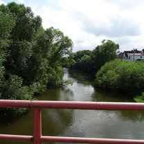
TAHUNA track
Saale-Tour Tag 1: Wolfenbüttel - Sieber (Herzberg) Teil 2
- -:--
- Duration
- 34.8 km
- Distance
- 518 m
- Ascent
- 637 m
- Descent
- ---
- Avg. speed
- ---
- Max. altitude

Part of
Saaletour 2017
12 stages
Route quality
Waytypes & surfaces along the route
Waytypes
Track
10.4 km
(30 %)
Quiet road
1.4 km
(4 %)
Undefined
23 km
(66 %)
Surfaces
Paved
34.4 km
(99 %)
Asphalt
33.7 km
(97 %)
Paved (undefined)
0.7 km
(2 %)
Undefined
0.3 km
(1 %)
Continue with Bikemap
Use, edit, or download this cycling route
You would like to ride 20170713_150229.gpx or customize it for your own trip? Here is what you can do with this Bikemap route:
Free features
- Save this route as favorite or in collections
- Copy & plan your own version of this route
- Sync your route with Garmin or Wahoo
Premium features
Free trial for 3 days, or one-time payment. More about Bikemap Premium.
- Navigate this route on iOS & Android
- Export a GPX / KML file of this route
- Create your custom printout (try it for free)
- Download this route for offline navigation
Discover more Premium features.
Get Bikemap PremiumFrom our community
Other popular routes starting in Wildemann
 32km Harz TL (Tri-Sport)
- Distance
- 32.2 km
- Ascent
- 344 m
- Descent
- 450 m
- Location
- Wildemann, Lower Saxony, Germany
 Mittelgroße Runde Wildemann-Goslar-Wildemann
- Distance
- 65.4 km
- Ascent
- 955 m
- Descent
- 966 m
- Location
- Wildemann, Lower Saxony, Germany
 Harzrunde09_01
- Distance
- 46.7 km
- Ascent
- 745 m
- Descent
- 738 m
- Location
- Wildemann, Lower Saxony, Germany
 Hahnenklee - Runde Granetalsperre
- Distance
- 23.7 km
- Ascent
- 487 m
- Descent
- 486 m
- Location
- Wildemann, Lower Saxony, Germany
 Harz TL 44 km Innerste-Stausee-Tour
- Distance
- 44 km
- Ascent
- 525 m
- Descent
- 519 m
- Location
- Wildemann, Lower Saxony, Germany
 Oberharzer Teiche- und Bäche-Tour
- Distance
- 82.3 km
- Ascent
- 1,365 m
- Descent
- 1,365 m
- Location
- Wildemann, Lower Saxony, Germany
 Wildemann-Dammhaus-Lohnau-Sösetalsperre-Prinzenteich-Wildemann
- Distance
- 70.1 km
- Ascent
- 1,026 m
- Descent
- 1,028 m
- Location
- Wildemann, Lower Saxony, Germany
 Hahnenklee - Oker-Stausee - Runde (Harz 2008)
- Distance
- 61.4 km
- Ascent
- 907 m
- Descent
- 908 m
- Location
- Wildemann, Lower Saxony, Germany
Open it in the app