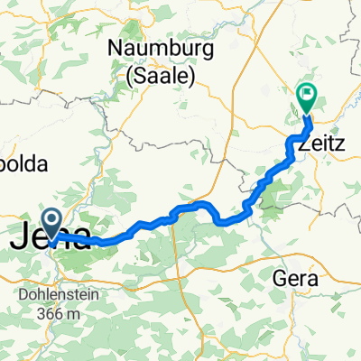
20170718_085424
A cycling route starting in Jena, Free State of Thuringia, Germany.
Overview
About this route
TAHUNA track
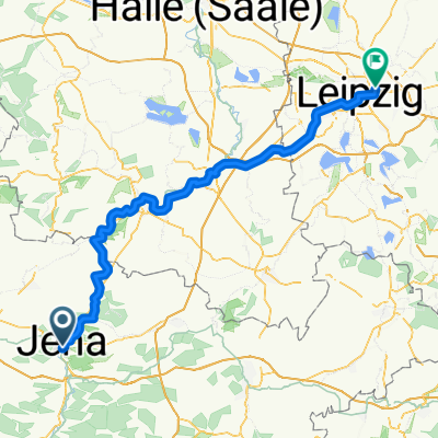
Saale-Tour Tag 6: von Jena nach Halle
- -:--
- Duration
- 113.5 km
- Distance
- 133 m
- Ascent
- 187 m
- Descent
- ---
- Avg. speed
- ---
- Avg. speed
Route photos
Route quality
Waytypes & surfaces along the route
Waytypes
Quiet road
27.9 km
(25 %)
Path
19.5 km
(17 %)
Surfaces
Paved
96.2 km
(85 %)
Unpaved
7.3 km
(6 %)
Asphalt
82.3 km
(72 %)
Paving stones
9.7 km
(9 %)
Continue with Bikemap
Use, edit, or download this cycling route
You would like to ride 20170718_085424 or customize it for your own trip? Here is what you can do with this Bikemap route:
Free features
- Save this route as favorite or in collections
- Copy & plan your own version of this route
- Sync your route with Garmin or Wahoo
Premium features
Free trial for 3 days, or one-time payment. More about Bikemap Premium.
- Navigate this route on iOS & Android
- Export a GPX / KML file of this route
- Create your custom printout (try it for free)
- Download this route for offline navigation
Discover more Premium features.
Get Bikemap PremiumFrom our community
Other popular routes starting in Jena
- : Halbtagestour mit Kindern
- Distance
- 29.6 km
- Ascent
- 185 m
- Descent
- 201 m
- Location
- Jena, Free State of Thuringia, Germany
- Feierabendrunde TPA
- Distance
- 38.5 km
- Ascent
- 443 m
- Descent
- 437 m
- Location
- Jena, Free State of Thuringia, Germany
- 4. Etappe Tour de Saale Jena - Naumburg
- Distance
- 55.7 km
- Ascent
- 405 m
- Descent
- 439 m
- Location
- Jena, Free State of Thuringia, Germany
- Tour um Jena, Jägerberg, Isserstedt , Magdala
- Distance
- 37.5 km
- Ascent
- 346 m
- Descent
- 344 m
- Location
- Jena, Free State of Thuringia, Germany
- Trainingsrunde
- Distance
- 34.9 km
- Ascent
- 559 m
- Descent
- 558 m
- Location
- Jena, Free State of Thuringia, Germany
- Jena - Leuchtenburg/St. Ganloff
- Distance
- 91.1 km
- Ascent
- 585 m
- Descent
- 585 m
- Location
- Jena, Free State of Thuringia, Germany
- Forst/Ammerbach
- Distance
- 14.2 km
- Ascent
- 291 m
- Descent
- 291 m
- Location
- Jena, Free State of Thuringia, Germany
- Jena - Stausee Hohenfelden - Kunitzburg - Jena CLONED FROM ROUTE 1736593
- Distance
- 109.9 km
- Ascent
- 623 m
- Descent
- 623 m
- Location
- Jena, Free State of Thuringia, Germany