Belluno - Enego
- 60.2 km
- 732 m
- 945 m
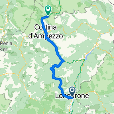
- Longarone, Veneto, Italy
A cycling route starting in Longarone, Veneto, Italy.
Overview
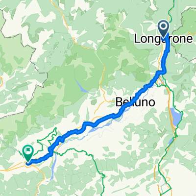
This route introduces us to the southern fringe of the Dolomites. First, we ride gently uphill through the wooded valley of the Zoldo Alto region. In the village of Villa, we turn left and continue climbing to Passo Duran (1601 m), which the organizers sometimes include in the program of the Giro d'Italia (1998, 2005). The climb is quite demanding, especially the beginning which is still in the village and then the entire upper half. The narrow road mostly goes through dense deciduous forest, which only retreats at the very top. Here we are greeted with a nice view of the edge of the Civetta massif. The descent starts gently with a nice view of the rocks of Civetta, then the road dives back into the woods and descends steeply into Agordo (this side is even more demanding than the one we came from). In Agordo, we pass through a lovely square and continue through the next valley to Cencenighe. Here we turn left, go around the tunnel on an old unused road, and continue our now steep (but still fair) climb to Falcade. In this small village lying under the rocks of the Pale di San Martino, we finish the route.
created this 17 years ago
Route quality
Quiet road
10.5 km
17 %
Track
2.5 km
4 %
Paved
51.5 km
(83 %)
Asphalt
50.2 km
81 %
Paved (undefined)
1.2 km
2 %
Undefined
10.5 km
17 %
Continue with Bikemap
You would like to ride Italské Alpy 2008 - Trasa 1 (Longarone - Falcade) or customize it for your own trip? Here is what you can do with this Bikemap route:
Free trial for 3 days, or one-time payment. More about Bikemap Premium.
Discover more Premium features.
Get Bikemap PremiumFrom our community
Open it in the app