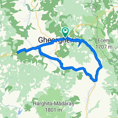
Gheorgheni - Pasul Pângărați - Covacipeter - Gheorgheni
A cycling route starting in Gheorgheni, Harghita County, Romania.
Overview
About this route
MTB
- -:--
- Duration
- 39.3 km
- Distance
- 1,003 m
- Ascent
- 1,031 m
- Descent
- ---
- Avg. speed
- ---
- Max. altitude
Route quality
Waytypes & surfaces along the route
Waytypes
Track
13.8 km
(35 %)
Quiet road
13.4 km
(34 %)
Undefined
12.2 km
(31 %)
Surfaces
Paved
11.8 km
(30 %)
Unpaved
26.7 km
(68 %)
Gravel
14.9 km
(38 %)
Asphalt
11.8 km
(30 %)
Continue with Bikemap
Use, edit, or download this cycling route
You would like to ride Gheorgheni - Pasul Pângărați - Covacipeter - Gheorgheni or customize it for your own trip? Here is what you can do with this Bikemap route:
Free features
- Save this route as favorite or in collections
- Copy & plan your own version of this route
- Sync your route with Garmin or Wahoo
Premium features
Free trial for 3 days, or one-time payment. More about Bikemap Premium.
- Navigate this route on iOS & Android
- Export a GPX / KML file of this route
- Create your custom printout (try it for free)
- Download this route for offline navigation
Discover more Premium features.
Get Bikemap PremiumFrom our community
Other popular routes starting in Gheorgheni
- izvorul Oltului -Pangarati
- Distance
- 31.9 km
- Ascent
- 652 m
- Descent
- 696 m
- Location
- Gheorgheni, Harghita County, Romania
- Szent-Anna kápolna
- Distance
- 9.7 km
- Ascent
- 286 m
- Descent
- 286 m
- Location
- Gheorgheni, Harghita County, Romania
- Piatra Singuratica
- Distance
- 28.8 km
- Ascent
- 982 m
- Descent
- 984 m
- Location
- Gheorgheni, Harghita County, Romania
- Hasmas
- Distance
- 104.4 km
- Ascent
- 1,784 m
- Descent
- 1,796 m
- Location
- Gheorgheni, Harghita County, Romania
- Kovacspeter
- Distance
- 38.9 km
- Ascent
- 987 m
- Descent
- 987 m
- Location
- Gheorgheni, Harghita County, Romania
- Gheorgheni - Lacu Rosu - Piatra Neamt - Targu Neamt
- Distance
- 129.1 km
- Ascent
- 724 m
- Descent
- 1,143 m
- Location
- Gheorgheni, Harghita County, Romania
- Gheorgheni Tour (long)
- Distance
- 92.6 km
- Ascent
- 906 m
- Descent
- 907 m
- Location
- Gheorgheni, Harghita County, Romania
- Gheorgheni - Pasul Pângărați - Covacipeter - Gheorgheni
- Distance
- 39.3 km
- Ascent
- 1,003 m
- Descent
- 1,031 m
- Location
- Gheorgheni, Harghita County, Romania
Open it in the app