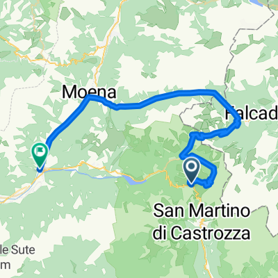
- 9.7 km
- 411 m
- 409 m
- Falcade, Veneto, Italy
Italské Alpy 2008 - Trasa 2 (Falcade - Torcegno)
A cycling route starting in Falcade, Veneto, Italy.
Overview
About this route
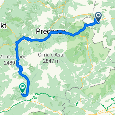
Today the route will take us through the southern Dolomites and we are faced with two really tough climbs. First, we will ascend to Passo Valles (2033 m), from which we have already conquered part of the elevation the previous day. But today it won’t be a stroll, as the gradient of the road constantly hovers between 8-9%, and some sections (like the turnoff to Passo San Pellegrino) are a true test of willpower. The views are only on one side, where a deep valley opens up beneath us, bordered by the mountain barrier of Monte Focobon (which can be seen well from the campsite in Falcade). From the summit, where a wooden chapel stands out, there follows an equally steep but short descent alongside the beautiful mountain stream Travignolo (something like the Bílá Opava below Praděd). This will lead us into the tourist region of Paneveggio. We continue on the flat around the large reservoir. The flat ends after a few kilometers, and further downhill we descend into the well-known town of Predazzo, which lies on the border of the Val di Fiemme and Val di Fassa valleys. We will ride the first of these. In addition to Predazzo, there is another well-known center here - Cavalese and many smaller villages. The valley lies at an altitude of 1000 m and offers excellent conditions for downhill and classic skiing as well as mountain biking. After this restful stretch, our legs will once again get a serious workout. We have to overcome the southernmost two-thousander of the Dolomites - Passo Manghen (2047m), which the cyclists had to tackle in this year's Giro. The road winding through the wooded valley is initially easy, but about halfway it gets significantly tougher, with the road narrowing to about half (the forest remains). The deadly gradient of 9-10% holds firm all the way to the top, with the final kilometers between mountain meadows being very beautiful. Traffic on the road is minimal. We count more cows than cars. The mountains around the pass belong marginally to the Lagorai range and have an atypical appearance for the Dolomites, resembling more so the Roháče. The descent from Manghen is a great experience. It is a joy to ride on the winding road 'in no man's land', and for lovers of high speeds, it’s a delight in the lower part of the descent when it rolls nicely again. At the junction above Telve, we do not continue the descent, but turn right and finish the stage a little above the village of Torcegno.
- -:--
- Duration
- 88.6 km
- Distance
- 2,558 m
- Ascent
- 2,995 m
- Descent
- ---
- Avg. speed
- 2,036 m
- Max. altitude
created this 17 years ago
Route quality
Waytypes & surfaces along the route
Waytypes
Quiet road
11.5 km
13 %
Road
9.7 km
11 %
Surfaces
Paved
58.5 km
(66 %)
Asphalt
51.4 km
58 %
Paved (undefined)
7.1 km
8 %
Undefined
30.1 km
34 %
Continue with Bikemap
Use, edit, or download this cycling route
You would like to ride Italské Alpy 2008 - Trasa 2 (Falcade - Torcegno) or customize it for your own trip? Here is what you can do with this Bikemap route:
Free features
- Save this route as favorite or in collections
- Copy & plan your own version of this route
- Split it into stages to create a multi-day tour
- Sync your route with Garmin or Wahoo
Premium features
Free trial for 3 days, or one-time payment. More about Bikemap Premium.
- Navigate this route on iOS & Android
- Export a GPX / KML file of this route
- Create your custom printout (try it for free)
- Download this route for offline navigation
Discover more Premium features.
Get Bikemap PremiumFrom our community
Other popular routes starting in Falcade
- Giro Juribello Malga Venegia
- Falcade - Sospirolo
- 60.4 km
- 2,203 m
- 3,416 m
- Falcade, Veneto, Italy
- Rolle, Manghen kör (2. verz): 166 km + 4000 m
- 166 km
- 4,060 m
- 4,086 m
- Falcade, Veneto, Italy
- The amazing Val Venegia and Baita Segantini - Tour 934
- 19.5 km
- 795 m
- 635 m
- Falcade, Veneto, Italy
- 20130711 falcade - falcade
- 108.5 km
- 2,366 m
- 2,366 m
- Falcade, Veneto, Italy
- Falcade - Alleghe - Passo Staulanza - Longarone - Pieve di Cadore
- 92.7 km
- 1,887 m
- 2,154 m
- Falcade, Veneto, Italy
- Passo Rolle Predazo alt
- 44 km
- 1,238 m
- 2,188 m
- Falcade, Veneto, Italy
- Italské Alpy 2008 - Trasa 2 (Falcade - Torcegno)
- 88.6 km
- 2,558 m
- 2,995 m
- Falcade, Veneto, Italy
Open it in the app


