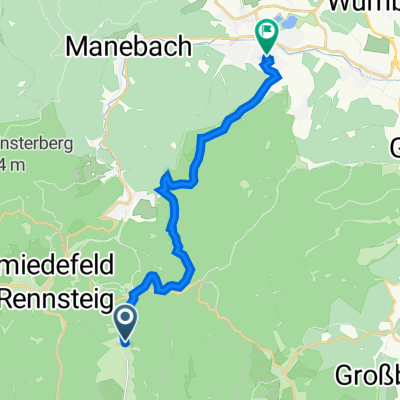
Frauenwald - Neustadt - Schönbrunn - Frauenwald
A cycling route starting in Frauenwald, Free State of Thuringia, Germany.
Overview
About this route
Frauenwald - Neustadt - Kahlert - Giessübel - Schönbrunn - Langenbach - Lichtenau - Steinbach - Frauenwald
- -:--
- Duration
- 38.5 km
- Distance
- 628 m
- Ascent
- 626 m
- Descent
- ---
- Avg. speed
- ---
- Max. altitude
Route quality
Waytypes & surfaces along the route
Waytypes
Busy road
16.1 km
(42 %)
Road
10.3 km
(27 %)
Surfaces
Paved
35 km
(91 %)
Unpaved
3.4 km
(9 %)
Asphalt
34.7 km
(90 %)
Gravel
2.8 km
(7 %)
Continue with Bikemap
Use, edit, or download this cycling route
You would like to ride Frauenwald - Neustadt - Schönbrunn - Frauenwald or customize it for your own trip? Here is what you can do with this Bikemap route:
Free features
- Save this route as favorite or in collections
- Copy & plan your own version of this route
- Sync your route with Garmin or Wahoo
Premium features
Free trial for 3 days, or one-time payment. More about Bikemap Premium.
- Navigate this route on iOS & Android
- Export a GPX / KML file of this route
- Create your custom printout (try it for free)
- Download this route for offline navigation
Discover more Premium features.
Get Bikemap PremiumFrom our community
Other popular routes starting in Frauenwald
- Schönbrunn - Schneekopf
- Distance
- 60.2 km
- Ascent
- 1,377 m
- Descent
- 1,118 m
- Location
- Frauenwald, Free State of Thuringia, Germany
- Rund um die Talsperre Schönbrunn
- Distance
- 16.3 km
- Ascent
- 474 m
- Descent
- 463 m
- Location
- Frauenwald, Free State of Thuringia, Germany
- Frauenwald / Hörschel 2.Tag
- Distance
- 56 km
- Ascent
- 724 m
- Descent
- 1,298 m
- Location
- Frauenwald, Free State of Thuringia, Germany
- Talsperre Schönbrunn
- Distance
- 28.3 km
- Ascent
- 864 m
- Descent
- 834 m
- Location
- Frauenwald, Free State of Thuringia, Germany
- Schönbrunn - Kickelhahn
- Distance
- 61.1 km
- Ascent
- 1,048 m
- Descent
- 1,058 m
- Location
- Frauenwald, Free State of Thuringia, Germany
- Talsperre Schönbrunn (lang)
- Distance
- 16.3 km
- Ascent
- 414 m
- Descent
- 414 m
- Location
- Frauenwald, Free State of Thuringia, Germany
- Frauenwald-Finsterberg-Schneekopf-Dörrberg-Beerberg
- Distance
- 58.9 km
- Ascent
- 927 m
- Descent
- 927 m
- Location
- Frauenwald, Free State of Thuringia, Germany
- einrollrunde
- Distance
- 26 km
- Ascent
- 309 m
- Descent
- 267 m
- Location
- Frauenwald, Free State of Thuringia, Germany
Open it in the app