
Brief bike tour through Hpa Ann 1
A cycling route starting in Hpa-An, Kayin State, Myanmar.
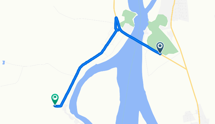
Overview
About this route
- 13 min
- Duration
- 5.8 km
- Distance
- 37 m
- Ascent
- 43 m
- Descent
- 27.8 km/h
- Avg. speed
- ---
- Max. altitude

Route quality
Waytypes & surfaces along the route
Waytypes
Quiet road
3.8 km
(66 %)
Cycleway
2 km
(34 %)
Continue with Bikemap
Use, edit, or download this cycling route
You would like to ride Brief bike tour through Hpa Ann 1 or customize it for your own trip? Here is what you can do with this Bikemap route:
Free features
- Save this route as favorite or in collections
- Copy & plan your own version of this route
- Sync your route with Garmin or Wahoo
Premium features
Free trial for 3 days, or one-time payment. More about Bikemap Premium.
- Navigate this route on iOS & Android
- Export a GPX / KML file of this route
- Create your custom printout (try it for free)
- Download this route for offline navigation
Discover more Premium features.
Get Bikemap PremiumFrom our community
Other popular routes starting in Hpa-An
 hpaan to thaton
- Distance
- 53.1 km
- Ascent
- 96 m
- Descent
- 96 m
- Location
- Hpa-An, Kayin State, Myanmar
 1T04 Kawkareik
- Distance
- 98 km
- Ascent
- 194 m
- Descent
- 190 m
- Location
- Hpa-An, Kayin State, Myanmar
 hpaan to thaton
- Distance
- 23.1 km
- Ascent
- 68 m
- Descent
- 64 m
- Location
- Hpa-An, Kayin State, Myanmar
 Easy ride in Hpa-An
- Distance
- 35.2 km
- Ascent
- 257 m
- Descent
- 257 m
- Location
- Hpa-An, Kayin State, Myanmar
 Brief bike tour through Hpa Ann 1
- Distance
- 5.8 km
- Ascent
- 37 m
- Descent
- 43 m
- Location
- Hpa-An, Kayin State, Myanmar
 round city
- Distance
- 11 km
- Ascent
- 23 m
- Descent
- 23 m
- Location
- Hpa-An, Kayin State, Myanmar
 201602_hpaan to thaton
- Distance
- 51.9 km
- Ascent
- 77 m
- Descent
- 78 m
- Location
- Hpa-An, Kayin State, Myanmar
 ffddddd
- Distance
- 90.2 km
- Ascent
- 179 m
- Descent
- 162 m
- Location
- Hpa-An, Kayin State, Myanmar
Open it in the app