

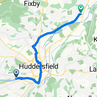
kendalls ice cream parlour hipperholme
A cycling route starting in Huddersfield, England, United Kingdom.
Overview
About this route
start sb hudds / mirfield ( on greenway ) ravensthorpe / liversage / cleckheaton / oakenshaw / shelf / stonechair / hipperholme. return reverse route
- -:--
- Duration
- 68.7 km
- Distance
- 498 m
- Ascent
- 371 m
- Descent
- ---
- Avg. speed
- ---
- Max. altitude
Continue with Bikemap
Use, edit, or download this cycling route
You would like to ride kendalls ice cream parlour hipperholme or customize it for your own trip? Here is what you can do with this Bikemap route:
Free features
- Save this route as favorite or in collections
- Copy & plan your own version of this route
- Sync your route with Garmin or Wahoo
Premium features
Free trial for 3 days, or one-time payment. More about Bikemap Premium.
- Navigate this route on iOS & Android
- Export a GPX / KML file of this route
- Create your custom printout (try it for free)
- Download this route for offline navigation
Discover more Premium features.
Get Bikemap PremiumFrom our community
Other popular routes starting in Huddersfield
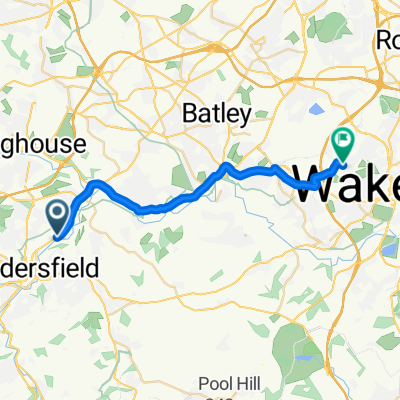 Leeds Road, Huddersfield to Lindale Mount, Wakefield
- Distance
- 19.3 km
- Ascent
- 290 m
- Descent
- 277 m
- Location
- Huddersfield, England, United Kingdom
 Thurstonland Hills
- Distance
- 31.3 km
- Ascent
- 479 m
- Descent
- 474 m
- Location
- Huddersfield, England, United Kingdom
 Huddersfield to Mirfield and back
- Distance
- 23.5 km
- Ascent
- 69 m
- Descent
- 179 m
- Location
- Huddersfield, England, United Kingdom
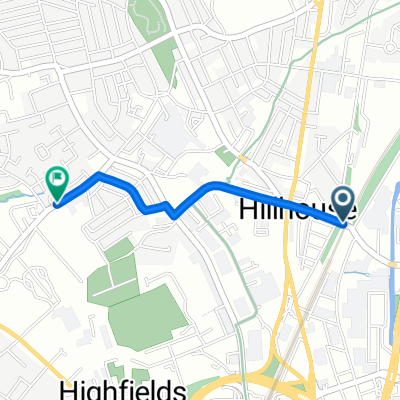 Route from Huddersfield
- Distance
- 1.5 km
- Ascent
- 43 m
- Descent
- 0 m
- Location
- Huddersfield, England, United Kingdom
 Route in Huddersfield
- Distance
- 7.2 km
- Ascent
- 40 m
- Descent
- 63 m
- Location
- Huddersfield, England, United Kingdom
 Thurstonland Hills
- Distance
- 31.3 km
- Ascent
- 437 m
- Descent
- 432 m
- Location
- Huddersfield, England, United Kingdom
 Brian Robinson Challenge, 17 April 2011
- Distance
- 118 km
- Ascent
- 1,473 m
- Descent
- 1,470 m
- Location
- Huddersfield, England, United Kingdom
 sb - oakwellhall
- Distance
- 51.1 km
- Ascent
- 434 m
- Descent
- 306 m
- Location
- Huddersfield, England, United Kingdom
Open it in the app