

Olimpijka
A cycling route starting in Bobrowniki, Łódź Voivodeship, Poland.
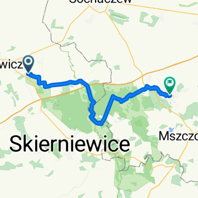
Overview
About this route
Śladami zaginionej autostrady Olimpijki. Od Mysłakowa do Konotopy. Miejscami trasa przebiega drogami polnymi lub nawet polami :), mimo to stałą prędkość podróżną szacuję na ok. 17km/h co daje ok 6,5h jazdy. Odcinek Konotopa-Powstańców Śląskich przebiega budowaną trasą ekspresową S8.
- -:--
- Duration
- 109 km
- Distance
- 52 m
- Ascent
- 26 m
- Descent
- ---
- Avg. speed
- ---
- Max. altitude

Route highlights
Points of interest along the route
Point of interest after 0.9 km
Park w Arkadii
Point of interest after 10.8 km
Most
Point of interest after 18.5 km
Most
Point of interest after 20.2 km
Most
Point of interest after 26.5 km
Dwupasmowa droga leśna
Point of interest after 29.6 km
Wiadukt
Point of interest after 32.6 km
Most
Point of interest after 44 km
Most
Point of interest after 52.7 km
Most
Point of interest after 57.3 km
Stonehenge :)
Point of interest after 65.6 km
Budowa wiaduktu
Point of interest after 68.1 km
Budowa wiaduktu
Point of interest after 70 km
Budowa węzła Tłuste
Point of interest after 72.3 km
Budowa wiaduktu
Point of interest after 76.7 km
Budowa wiaduktu
Point of interest after 77 km
Budowa MOP-II i MOP-III "Brwinów"
Point of interest after 78.7 km
Budowa wiaduktu
Point of interest after 82.3 km
Budowa wiaduktu
Point of interest after 84.7 km
Sklep spożywczy
Point of interest after 86.4 km
Budowa wiaduktu
Point of interest after 86.7 km
Budowa wiaduktu i węzła "Pruszków"
Point of interest after 88.7 km
Budowa wiaduktu
Point of interest after 93.9 km
Budowa węzła "Konotopa". Koniec Autostrady A2. Rozwidlenie na trasę ekspresową S8 i Południową Obwodnicę Warszawy.
Continue with Bikemap
Use, edit, or download this cycling route
You would like to ride Olimpijka or customize it for your own trip? Here is what you can do with this Bikemap route:
Free features
- Save this route as favorite or in collections
- Copy & plan your own version of this route
- Split it into stages to create a multi-day tour
- Sync your route with Garmin or Wahoo
Premium features
Free trial for 3 days, or one-time payment. More about Bikemap Premium.
- Navigate this route on iOS & Android
- Export a GPX / KML file of this route
- Create your custom printout (try it for free)
- Download this route for offline navigation
Discover more Premium features.
Get Bikemap PremiumFrom our community
Other popular routes starting in Bobrowniki
 Olimpijka
- Distance
- 109 km
- Ascent
- 52 m
- Descent
- 26 m
- Location
- Bobrowniki, Łódź Voivodeship, Poland
 gjgfj
gjgfj- Distance
- 3,255.9 km
- Ascent
- 1,397 m
- Descent
- 1,393 m
- Location
- Bobrowniki, Łódź Voivodeship, Poland
 Recovered Route
- Distance
- 88.4 km
- Ascent
- 468 m
- Descent
- 490 m
- Location
- Bobrowniki, Łódź Voivodeship, Poland
 Mysłaków k. Łowicza - Arkadia - Nieborów - Skierniewice
- Distance
- 22.7 km
- Ascent
- 87 m
- Descent
- 54 m
- Location
- Bobrowniki, Łódź Voivodeship, Poland
 Szlak "Radziwiłłowski" (rowerowy, zielony)
- Distance
- 26.4 km
- Ascent
- 82 m
- Descent
- 63 m
- Location
- Bobrowniki, Łódź Voivodeship, Poland
 From Nieborów to Żyrardów
- Distance
- 48.2 km
- Ascent
- 131 m
- Descent
- 99 m
- Location
- Bobrowniki, Łódź Voivodeship, Poland
 Bolimowski Park Krajobrazowy
- Distance
- 59.3 km
- Ascent
- 224 m
- Descent
- 223 m
- Location
- Bobrowniki, Łódź Voivodeship, Poland
 NIEBOROW TT
- Distance
- 17.3 km
- Ascent
- 30 m
- Descent
- 31 m
- Location
- Bobrowniki, Łódź Voivodeship, Poland
Open it in the app