Ruidera-Osa de Montiel y vuelta por La CaƱada del Hornillo
A cycling route starting in Ruidera, Castille-La Mancha, Spain.
Overview
About this route
The route runs through an area of Mediterranean forest, except for some small steep climbs and some technical descents that can be done off the bike; the rest is rideable and very fun within a unique environment.
- -:--
- Duration
- 37.3 km
- Distance
- 404 m
- Ascent
- 405 m
- Descent
- ---
- Avg. speed
- ---
- Max. altitude
Continue with Bikemap
Use, edit, or download this cycling route
You would like to ride Ruidera-Osa de Montiel y vuelta por La CaƱada del Hornillo or customize it for your own trip? Here is what you can do with this Bikemap route:
Free features
- Save this route as favorite or in collections
- Copy & plan your own version of this route
- Sync your route with Garmin or Wahoo
Premium features
Free trial for 3 days, or one-time payment. More about Bikemap Premium.
- Navigate this route on iOS & Android
- Export a GPX / KML file of this route
- Create your custom printout (try it for free)
- Download this route for offline navigation
Discover more Premium features.
Get Bikemap PremiumFrom our community
Other popular routes starting in Ruidera
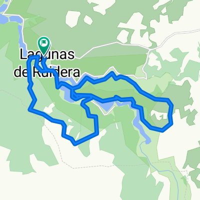
- Bordeando las Lagunas de Ruidera
- Distance
- 50.1 km
- Ascent
- 189 m
- Descent
- 186 m
- Location
- Ruidera, Castille-La Mancha, Spain
- La Mancha 6: Ruidera-lagunas-Ruidera
- Distance
- 30.2 km
- Ascent
- 207 m
- Descent
- 208 m
- Location
- Ruidera, Castille-La Mancha, Spain
- Camping los Batanes-Argamasilla-El Bolillo-Ruidera-Camping
- Distance
- 92.9 km
- Ascent
- 464 m
- Descent
- 464 m
- Location
- Ruidera, Castille-La Mancha, Spain
- La Mancha 7: Ruidera-Ossa de Montiel-Viveros-Canaleja-Alcaraz
- Distance
- 64.6 km
- Ascent
- 483 m
- Descent
- 297 m
- Location
- Ruidera, Castille-La Mancha, Spain
- Ruidera 24-02-2013
- Distance
- 39.2 km
- Ascent
- 493 m
- Descent
- 493 m
- Location
- Ruidera, Castille-La Mancha, Spain
- Ruidera Camping Los Batanes - La Solana
- Distance
- 53.1 km
- Ascent
- 272 m
- Descent
- 369 m
- Location
- Ruidera, Castille-La Mancha, Spain
- BaƱo las mulas-Cortes-BaƱo las mulas
- Distance
- 120.3 km
- Ascent
- 522 m
- Descent
- 516 m
- Location
- Ruidera, Castille-La Mancha, Spain
- Lagunas de Ruidera - Castillo de Rochafrida - Cueva Montesin...
- Distance
- 10.8 km
- Ascent
- 178 m
- Descent
- 178 m
- Location
- Ruidera, Castille-La Mancha, Spain
Open it in the app