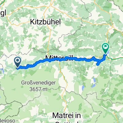
Brixen im Thale - Hopfgarten - Schafsiedel
A cycling route starting in Wald im Pinzgau, Salzburg, Austria.
Overview
About this route
This biking trip was leading from the town Brixen im Thale in Kitzbühel Alps, by a bike path to Hopfgarten in Brixental and then by a paved road and gravel road to a mountain hut at about 1200 m asl. In this point we left our bikes and went by foot to Schafsidel summit (2447 m). See this hiking trip at http://www.wandermap.net/en/route/3531874-schafsiedel/. Later down again to Hopfgarten.
It's very nice trip leading on beautiful valley and it also lets you soak up the views from the top of one of the highest mount in this region.
Read more on my blog when I described also other biking and hiking routes in this mountains: http://majatravels.com/biking-and-hiking-in-kitzbuhel-alps/
- -:--
- Duration
- 45 km
- Distance
- 815 m
- Ascent
- 801 m
- Descent
- ---
- Avg. speed
- ---
- Max. altitude
Route quality
Waytypes & surfaces along the route
Waytypes
Quiet road
21.6 km
(48 %)
Road
3.6 km
(8 %)
Surfaces
Paved
29.7 km
(66 %)
Unpaved
2.2 km
(5 %)
Asphalt
29.2 km
(65 %)
Gravel
1.8 km
(4 %)
Continue with Bikemap
Use, edit, or download this cycling route
You would like to ride Brixen im Thale - Hopfgarten - Schafsiedel or customize it for your own trip? Here is what you can do with this Bikemap route:
Free features
- Save this route as favorite or in collections
- Copy & plan your own version of this route
- Sync your route with Garmin or Wahoo
Premium features
Free trial for 3 days, or one-time payment. More about Bikemap Premium.
- Navigate this route on iOS & Android
- Export a GPX / KML file of this route
- Create your custom printout (try it for free)
- Download this route for offline navigation
Discover more Premium features.
Get Bikemap PremiumFrom our community
Other popular routes starting in Wald im Pinzgau
 2.den ck poznání
- Distance
- 53 km
- Ascent
- 154 m
- Descent
- 258 m
- Location
- Wald im Pinzgau, Salzburg, Austria
 Grossvenediger Skitour
- Distance
- 24.2 km
- Ascent
- 2,758 m
- Descent
- 76 m
- Location
- Wald im Pinzgau, Salzburg, Austria
 Transalp Bert 2016 Etape 2
- Distance
- 83.5 km
- Ascent
- 1,758 m
- Descent
- 1,804 m
- Location
- Wald im Pinzgau, Salzburg, Austria
 Hotel Abelhof - Krimml Waterfall round trip
- Distance
- 31.1 km
- Ascent
- 807 m
- Descent
- 807 m
- Location
- Wald im Pinzgau, Salzburg, Austria
 Fabi & Tobi
- Distance
- 4.5 km
- Ascent
- 44 m
- Descent
- 388 m
- Location
- Wald im Pinzgau, Salzburg, Austria
 1_TAUERN
- Distance
- 62.7 km
- Ascent
- 444 m
- Descent
- 584 m
- Location
- Wald im Pinzgau, Salzburg, Austria
 Von wald über die Resterhöhe ins Mühlbachtal und über den Wildkogel wieder nach Hollersbach.
- Distance
- 65 km
- Ascent
- 1,982 m
- Descent
- 1,983 m
- Location
- Wald im Pinzgau, Salzburg, Austria
 návrh Krimml 1
- Distance
- 255.7 km
- Ascent
- 3,841 m
- Descent
- 3,855 m
- Location
- Wald im Pinzgau, Salzburg, Austria
Open it in the app


