

I_Trentino_Monte-Rovere---Forte-Spitz-Vezzano
A cycling route starting in Gionghi-Cappella, Trentino-Alto Adige, Italy.
Overview
About this route
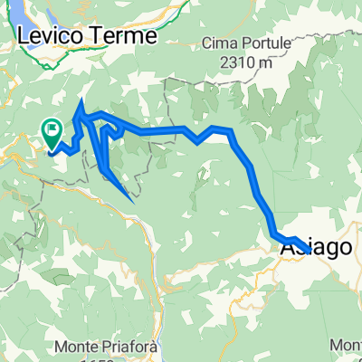
from Malga Morcai to the top Vezzano it goes up with a 10% incline on a partly fist-sized gravel path, possibly needing to push. From the top, there is a breathtaking view of Caldonazo Lake and Levico Terme. Anyone who wants should go to the platform and look straight down through the grate to test their altitude resistance.
- -:--
- Duration
- 22.1 km
- Distance
- 670 m
- Ascent
- 676 m
- Descent
- ---
- Avg. speed
- ---
- Max. altitude

Continue with Bikemap
Use, edit, or download this cycling route
You would like to ride I_Trentino_Monte-Rovere---Forte-Spitz-Vezzano or customize it for your own trip? Here is what you can do with this Bikemap route:
Free features
- Save this route as favorite or in collections
- Copy & plan your own version of this route
- Sync your route with Garmin or Wahoo
Premium features
Free trial for 3 days, or one-time payment. More about Bikemap Premium.
- Navigate this route on iOS & Android
- Export a GPX / KML file of this route
- Create your custom printout (try it for free)
- Download this route for offline navigation
Discover more Premium features.
Get Bikemap PremiumFrom our community
Other popular routes starting in Gionghi-Cappella
 Asiago-Luserna
- Distance
- 70.5 km
- Ascent
- 1,500 m
- Descent
- 1,500 m
- Location
- Gionghi-Cappella, Trentino-Alto Adige, Italy
 03D Grand Hotel Astoria1 do Grand Hotel Astoria1
- Distance
- 221.2 km
- Ascent
- 4,247 m
- Descent
- 4,247 m
- Location
- Gionghi-Cappella, Trentino-Alto Adige, Italy
 Friedensweg Levico
- Distance
- 19.1 km
- Ascent
- 337 m
- Descent
- 1,128 m
- Location
- Gionghi-Cappella, Trentino-Alto Adige, Italy
 Wanderung Lavarone - Bisele di Sotto
- Distance
- 13.6 km
- Ascent
- 658 m
- Descent
- 489 m
- Location
- Gionghi-Cappella, Trentino-Alto Adige, Italy
 100 km dei forti - lavarone
- Distance
- 18.3 km
- Ascent
- 365 m
- Descent
- 365 m
- Location
- Gionghi-Cappella, Trentino-Alto Adige, Italy
 Altipiani Lavarone - Luserna
- Distance
- 42.5 km
- Ascent
- 1,202 m
- Descent
- 1,201 m
- Location
- Gionghi-Cappella, Trentino-Alto Adige, Italy
 I_Trentino_Monte-Rovere---Forte-Spitz-Vezzano
- Distance
- 22.1 km
- Ascent
- 670 m
- Descent
- 676 m
- Location
- Gionghi-Cappella, Trentino-Alto Adige, Italy
 Fatbike Lavarone anello 18km
- Distance
- 15 km
- Ascent
- 384 m
- Descent
- 383 m
- Location
- Gionghi-Cappella, Trentino-Alto Adige, Italy
Open it in the app