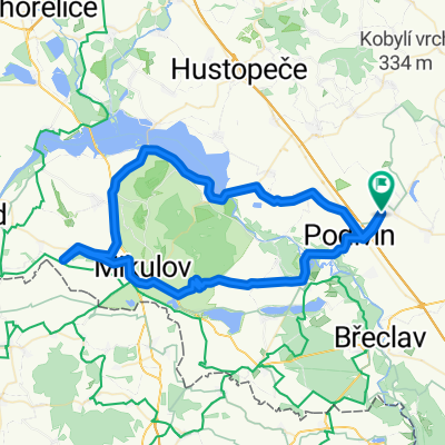
2017_07_29 Bilovice V
A cycling route starting in Velké Bílovice, South Moravian, Czechia.
Overview
About this route
TAHUNA track - V.Bílovice, M.Žižkov, Břeclav, Lednice, Podivín, V.Bílovice
- -:--
- Duration
- 40.9 km
- Distance
- 156 m
- Ascent
- 159 m
- Descent
- ---
- Avg. speed
- ---
- Avg. speed
Route quality
Waytypes & surfaces along the route
Waytypes
Track
12.5 km
(31 %)
Quiet road
11.3 km
(28 %)
Surfaces
Paved
21.8 km
(53 %)
Unpaved
5.5 km
(13 %)
Asphalt
21.3 km
(52 %)
Gravel
3.7 km
(9 %)
Continue with Bikemap
Use, edit, or download this cycling route
You would like to ride 2017_07_29 Bilovice V or customize it for your own trip? Here is what you can do with this Bikemap route:
Free features
- Save this route as favorite or in collections
- Copy & plan your own version of this route
- Sync your route with Garmin or Wahoo
Premium features
Free trial for 3 days, or one-time payment. More about Bikemap Premium.
- Navigate this route on iOS & Android
- Export a GPX / KML file of this route
- Create your custom printout (try it for free)
- Download this route for offline navigation
Discover more Premium features.
Get Bikemap PremiumFrom our community
Other popular routes starting in Velké Bílovice
- 2017_07_29 Bilovice V
- Distance
- 40.9 km
- Ascent
- 156 m
- Descent
- 159 m
- Location
- Velké Bílovice, South Moravian, Czechia
- 2017_07_25 Bilovice II
- Distance
- 49.2 km
- Ascent
- 245 m
- Descent
- 246 m
- Location
- Velké Bílovice, South Moravian, Czechia
- 2017_07_27 Bílovice III
- Distance
- 34.7 km
- Ascent
- 189 m
- Descent
- 186 m
- Location
- Velké Bílovice, South Moravian, Czechia
- Vinné Tour 2007 1.dem
- Distance
- 15.5 km
- Ascent
- 136 m
- Descent
- 81 m
- Location
- Velké Bílovice, South Moravian, Czechia
- 2017_07_28 Bilovice IV
- Distance
- 30.3 km
- Ascent
- 346 m
- Descent
- 346 m
- Location
- Velké Bílovice, South Moravian, Czechia
- Vinné tour 2007 2.den
- Distance
- 70.1 km
- Ascent
- 266 m
- Descent
- 266 m
- Location
- Velké Bílovice, South Moravian, Czechia
- 2017_07_24 Bilovice I
- Distance
- 32.5 km
- Ascent
- 272 m
- Descent
- 272 m
- Location
- Velké Bílovice, South Moravian, Czechia
- lehká trasa V.Bílovice-Mikulčice, hradiště
- Distance
- 18.2 km
- Ascent
- 53 m
- Descent
- 72 m
- Location
- Velké Bílovice, South Moravian, Czechia
Open it in the app