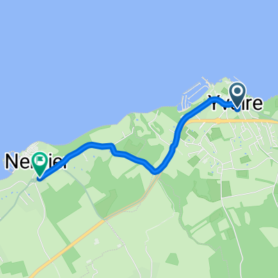
47°Nord Tour de Suisse Etappe 3
A cycling route starting in Messery, Auvergne-Rhône-Alpes, France.
Overview
About this route
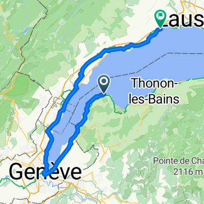
Von Nyon geht es per Schiff nach Yvoire (F) dort erwartet uns ein schmucke Altstadt mit vielen kleinen Geschäften. Weiter geht die Reise dem Ufer des Lac Lémans entlang. Die route führt teils über Radwege von Evian folgt sie der Hauptstrasse direkt am Ufer. Ab Le Bouveret verläuft die Strecke entlang der Veloland Schweiz Route No1 bis nach Aigle
- -:--
- Duration
- 66.2 km
- Distance
- 342 m
- Ascent
- 321 m
- Descent
- ---
- Avg. speed
- ---
- Avg. speed
Route photos
Route quality
Waytypes & surfaces along the route
Waytypes
Busy road
23.5 km
(35 %)
Road
13.9 km
(21 %)
Surfaces
Paved
53.8 km
(81 %)
Unpaved
0.2 km
(<1 %)
Asphalt
53.4 km
(81 %)
Wood
0.2 km
(<1 %)
Continue with Bikemap
Use, edit, or download this cycling route
You would like to ride 47°Nord Tour de Suisse Etappe 3 or customize it for your own trip? Here is what you can do with this Bikemap route:
Free features
- Save this route as favorite or in collections
- Copy & plan your own version of this route
- Sync your route with Garmin or Wahoo
Premium features
Free trial for 3 days, or one-time payment. More about Bikemap Premium.
- Navigate this route on iOS & Android
- Export a GPX / KML file of this route
- Create your custom printout (try it for free)
- Download this route for offline navigation
Discover more Premium features.
Get Bikemap PremiumFrom our community
Other popular routes starting in Messery
- GenferSee(F) - LacAnnecy - LacBourget
- Distance
- 140.6 km
- Ascent
- 1,412 m
- Descent
- 1,559 m
- Location
- Messery, Auvergne-Rhône-Alpes, France
- Elvetia-Franta 2010. Ziua 10
- Distance
- 20.9 km
- Ascent
- 131 m
- Descent
- 148 m
- Location
- Messery, Auvergne-Rhône-Alpes, France
- Yvoire to Taninges 82km 1740m climbing
- Distance
- 82.4 km
- Ascent
- 1,731 m
- Descent
- 1,467 m
- Location
- Messery, Auvergne-Rhône-Alpes, France
- (05) Messery - Morzine
- Distance
- 92.6 km
- Ascent
- 1,461 m
- Descent
- 969 m
- Location
- Messery, Auvergne-Rhône-Alpes, France
- Nernier - Ballaison - Col de Saxel - Arbère Poche- Col du Feu- Port de Sechex - Nernier
- Distance
- 83.6 km
- Ascent
- 1,532 m
- Descent
- 1,537 m
- Location
- Messery, Auvergne-Rhône-Alpes, France
- haute route alps juli 2015 ch/u
- Distance
- 728.6 km
- Ascent
- 13,408 m
- Descent
- 13,771 m
- Location
- Messery, Auvergne-Rhône-Alpes, France
- haute-route-aps 2015 ch/u
- Distance
- 732.5 km
- Ascent
- 13,954 m
- Descent
- 14,326 m
- Location
- Messery, Auvergne-Rhône-Alpes, France
- Thonen to GVA
- Distance
- 27.4 km
- Ascent
- 155 m
- Descent
- 135 m
- Location
- Messery, Auvergne-Rhône-Alpes, France
Open it in the app