

47° Nord Tour de Suisse Etappe7
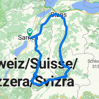
A cycling route starting in Sarnen, Canton of Obwalden, Switzerland.
Overview
About this route
Von Brienz nach Sarnen entlang der Veloland Route No 9. Bis nach Meiringen verläuft die Route nahezu flach, danach steig sie steill hinauf zum Hasliberg und von dort hinauf auf den Brünigpass. Von dort geht es hinuter zum Lugernsee und anschliessen hinumter an den Sarnersee. Die Route verläuft auf neben Strassen, zum Tiel Kieswegen
- -:--
- Duration
- 45.1 km
- Distance
- 709 m
- Ascent
- 616 m
- Descent
- ---
- Avg. speed
- ---
- Max. altitude

Route quality
Waytypes & surfaces along the route
Waytypes
Quiet road
25.4 km
(56 %)
Road
14.2 km
(31 %)
Surfaces
Paved
25.5 km
(57 %)
Unpaved
3.8 km
(9 %)
Asphalt
23.8 km
(53 %)
Gravel
1.9 km
(4 %)
Continue with Bikemap
Use, edit, or download this cycling route
You would like to ride 47° Nord Tour de Suisse Etappe7 or customize it for your own trip? Here is what you can do with this Bikemap route:
Free features
- Save this route as favorite or in collections
- Copy & plan your own version of this route
- Sync your route with Garmin or Wahoo
Premium features
Free trial for 3 days, or one-time payment. More about Bikemap Premium.
- Navigate this route on iOS & Android
- Export a GPX / KML file of this route
- Create your custom printout (try it for free)
- Download this route for offline navigation
Discover more Premium features.
Get Bikemap PremiumFrom our community
Other popular routes starting in Sarnen
 Sarnen, Ei nach Sarnen, Ei
- Distance
- 19.4 km
- Ascent
- 141 m
- Descent
- 131 m
- Location
- Sarnen, Canton of Obwalden, Switzerland
 Scheidegg
- Distance
- 132.6 km
- Ascent
- 2,362 m
- Descent
- 2,350 m
- Location
- Sarnen, Canton of Obwalden, Switzerland
 Sarnersee-Giswil-FlüeliRanft
- Distance
- 33.5 km
- Ascent
- 795 m
- Descent
- 792 m
- Location
- Sarnen, Canton of Obwalden, Switzerland
 Mueterschwanderbergtrail
- Distance
- 30.2 km
- Ascent
- 618 m
- Descent
- 617 m
- Location
- Sarnen, Canton of Obwalden, Switzerland
 Seestrasse 20, Sarnen nach Flecken 11, Rothenburg
- Distance
- 53.6 km
- Ascent
- 2,182 m
- Descent
- 2,164 m
- Location
- Sarnen, Canton of Obwalden, Switzerland
 Over Älggi to Melchsee
- Distance
- 71.6 km
- Ascent
- 2,434 m
- Descent
- 2,406 m
- Location
- Sarnen, Canton of Obwalden, Switzerland
 Gerade Fahrt in Sarnen
- Distance
- 31.9 km
- Ascent
- 305 m
- Descent
- 306 m
- Location
- Sarnen, Canton of Obwalden, Switzerland
 Tour deluxe
- Distance
- 70.3 km
- Ascent
- 2,111 m
- Descent
- 2,110 m
- Location
- Sarnen, Canton of Obwalden, Switzerland
Open it in the app