

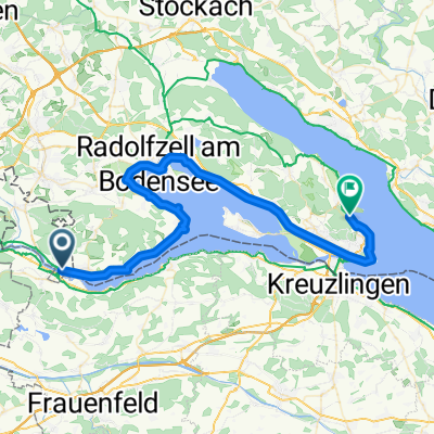
Stein Am Rhein-Konstanz
A cycling route starting in Stein am Rhein, Canton of Schaffhausen, Switzerland.
Overview
About this route
Primera etapa de la volta al llac de Constança (Bodense). Comenem el dia amb pluja que no ens deixarà fins passat Radolfzell. El sel completament tapat i amb un color plomis que feia que l'aigua del llac es confongués amb el cel.
Això va fer que no poguéssim visitar els poblets per passavem i altres per feina a fer quilòmetres. Al parar la pluja sols va servir perquè s'adquireixi la roba ja que el cel ens va obrir.
El terreny pla, asfalt i en llocs grava
- -:--
- Duration
- 45.8 km
- Distance
- 139 m
- Ascent
- 113 m
- Descent
- ---
- Avg. speed
- ---
- Max. altitude

Route quality
Waytypes & surfaces along the route
Waytypes
Path
17.9 km
(39 %)
Quiet road
14.6 km
(32 %)
Surfaces
Paved
39.9 km
(87 %)
Unpaved
4.9 km
(11 %)
Asphalt
39.5 km
(86 %)
Gravel
2.9 km
(6 %)
Continue with Bikemap
Use, edit, or download this cycling route
You would like to ride Stein Am Rhein-Konstanz or customize it for your own trip? Here is what you can do with this Bikemap route:
Free features
- Save this route as favorite or in collections
- Copy & plan your own version of this route
- Sync your route with Garmin or Wahoo
Premium features
Free trial for 3 days, or one-time payment. More about Bikemap Premium.
- Navigate this route on iOS & Android
- Export a GPX / KML file of this route
- Create your custom printout (try it for free)
- Download this route for offline navigation
Discover more Premium features.
Get Bikemap PremiumFrom our community
Other popular routes starting in Stein am Rhein
 Rund um den Bodensee
- Distance
- 239.4 km
- Ascent
- 247 m
- Descent
- 250 m
- Location
- Stein am Rhein, Canton of Schaffhausen, Switzerland
 Rathausplatz 7, Stein am Rhein to Rümikerstrasse 50, Winterthur
- Distance
- 28 km
- Ascent
- 331 m
- Descent
- 262 m
- Location
- Stein am Rhein, Canton of Schaffhausen, Switzerland
 Hemmenhofen Schaffhausen und zurück
- Distance
- 62.8 km
- Ascent
- 191 m
- Descent
- 191 m
- Location
- Stein am Rhein, Canton of Schaffhausen, Switzerland
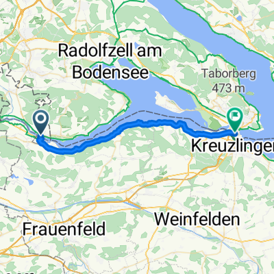
 Route nach Konstanz
- Distance
- 53 km
- Ascent
- 294 m
- Descent
- 300 m
- Location
- Stein am Rhein, Canton of Schaffhausen, Switzerland
 Vom Bodensee zur Nordsee
- Distance
- 1,086.3 km
- Ascent
- 69 m
- Descent
- 462 m
- Location
- Stein am Rhein, Canton of Schaffhausen, Switzerland
 Rheinfall
- Distance
- 25.3 km
- Ascent
- 170 m
- Descent
- 174 m
- Location
- Stein am Rhein, Canton of Schaffhausen, Switzerland
 Obergass nach Untere Laube
- Distance
- 29.1 km
- Ascent
- 367 m
- Descent
- 368 m
- Location
- Stein am Rhein, Canton of Schaffhausen, Switzerland
 Stein am Rhein - Schaffhausen
- Distance
- 50.2 km
- Ascent
- 202 m
- Descent
- 203 m
- Location
- Stein am Rhein, Canton of Schaffhausen, Switzerland
Open it in the app