

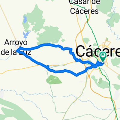
CC - Barruecos - Cefot - CC
A cycling route starting in Cáceres, Extremadura, Spain.
Overview
About this route
- -:--
- Duration
- 38.9 km
- Distance
- 204 m
- Ascent
- 230 m
- Descent
- ---
- Avg. speed
- ---
- Max. altitude

Continue with Bikemap
Use, edit, or download this cycling route
You would like to ride CC - Barruecos - Cefot - CC or customize it for your own trip? Here is what you can do with this Bikemap route:
Free features
- Save this route as favorite or in collections
- Copy & plan your own version of this route
- Sync your route with Garmin or Wahoo
Premium features
Free trial for 3 days, or one-time payment. More about Bikemap Premium.
- Navigate this route on iOS & Android
- Export a GPX / KML file of this route
- Create your custom printout (try it for free)
- Download this route for offline navigation
Discover more Premium features.
Get Bikemap PremiumFrom our community
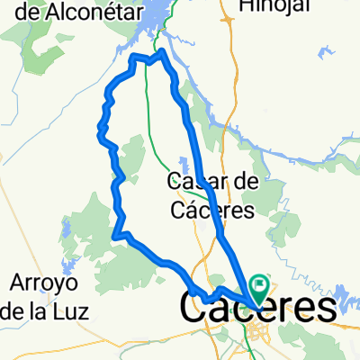
Other popular routes starting in Cáceres
 Merendero de la Ex-100
- Distance
- 66 km
- Ascent
- 290 m
- Descent
- 286 m
- Location
- Cáceres, Extremadura, Spain
 Altagracia
- Distance
- 68.4 km
- Ascent
- 294 m
- Descent
- 294 m
- Location
- Cáceres, Extremadura, Spain
 RUTA 7- CC-ARENALES-ARROYO
- Distance
- 44.9 km
- Ascent
- 169 m
- Descent
- 176 m
- Location
- Cáceres, Extremadura, Spain
 Ruta de las dos vírgenes
- Distance
- 64.1 km
- Ascent
- 341 m
- Descent
- 343 m
- Location
- Cáceres, Extremadura, Spain
 CC - Barruecos - Cefot - CC
- Distance
- 38.9 km
- Ascent
- 204 m
- Descent
- 230 m
- Location
- Cáceres, Extremadura, Spain
 CASAR- RIBEROS MONROY
- Distance
- 73.6 km
- Ascent
- 543 m
- Descent
- 538 m
- Location
- Cáceres, Extremadura, Spain
 Cáceres - Ermita de San Jorge
- Distance
- 38.3 km
- Ascent
- 360 m
- Descent
- 337 m
- Location
- Cáceres, Extremadura, Spain
 Cáceres - Plasencia MTB
- Distance
- 93.6 km
- Ascent
- 677 m
- Descent
- 699 m
- Location
- Cáceres, Extremadura, Spain
Open it in the app