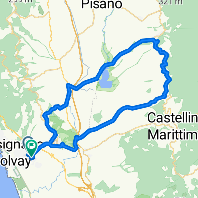
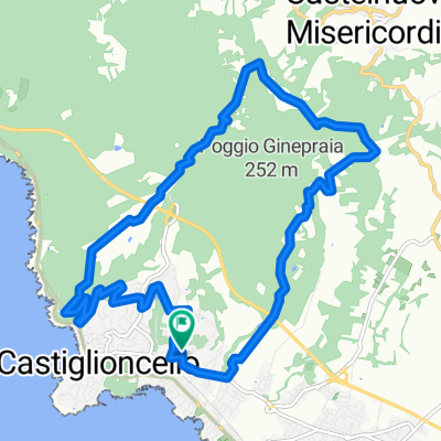
castagneto carducci-larderello
A cycling route starting in Rosignano Solvay-Castiglioncello, Tuscany, Italy.
Overview
About this route
The more information you provide here, the more useful it will be for other users.
- Route progress.
- What is special about this route?
- Why recommend this route?
- What did you like most here?
- Etc.
- -:--
- Duration
- 141.8 km
- Distance
- 1,600 m
- Ascent
- 1,592 m
- Descent
- ---
- Avg. speed
- 529 m
- Max. altitude
Route quality
Waytypes & surfaces along the route
Waytypes
Quiet road
15.6 km
(11 %)
Cycleway
9.9 km
(7 %)
Surfaces
Paved
110.6 km
(78 %)
Unpaved
4.3 km
(3 %)
Asphalt
110.6 km
(78 %)
Gravel
2.8 km
(2 %)
Continue with Bikemap
Use, edit, or download this cycling route
You would like to ride castagneto carducci-larderello or customize it for your own trip? Here is what you can do with this Bikemap route:
Free features
- Save this route as favorite or in collections
- Copy & plan your own version of this route
- Split it into stages to create a multi-day tour
- Sync your route with Garmin or Wahoo
Premium features
Free trial for 3 days, or one-time payment. More about Bikemap Premium.
- Navigate this route on iOS & Android
- Export a GPX / KML file of this route
- Create your custom printout (try it for free)
- Download this route for offline navigation
Discover more Premium features.
Get Bikemap PremiumFrom our community
Other popular routes starting in Rosignano Solvay-Castiglioncello
piombino-venturina- Distance
- 116.9 km
- Ascent
- 150 m
- Descent
- 146 m
- Location
- Rosignano Solvay-Castiglioncello, Tuscany, Italy
castiglioncello-suvereto CLONED FROM ROUTE 413893- Distance
- 125.4 km
- Ascent
- 465 m
- Descent
- 465 m
- Location
- Rosignano Solvay-Castiglioncello, Tuscany, Italy
Roisignano S.-Castelnuovo-Gabbro-Poggio Pelato-Ros.Solvay- Distance
- 44.2 km
- Ascent
- 700 m
- Descent
- 699 m
- Location
- Rosignano Solvay-Castiglioncello, Tuscany, Italy
castagneto carducci-larderello- Distance
- 141.8 km
- Ascent
- 1,600 m
- Descent
- 1,592 m
- Location
- Rosignano Solvay-Castiglioncello, Tuscany, Italy
Percorso da Via Bruno Buozzi- Distance
- 34.2 km
- Ascent
- 532 m
- Descent
- 574 m
- Location
- Rosignano Solvay-Castiglioncello, Tuscany, Italy
canotto-castagneto- Distance
- 103.8 km
- Ascent
- 708 m
- Descent
- 703 m
- Location
- Rosignano Solvay-Castiglioncello, Tuscany, Italy
Ros. Solvay-anello Sambuca-Montenero-Solvay- Distance
- 65.3 km
- Ascent
- 1,454 m
- Descent
- 1,456 m
- Location
- Rosignano Solvay-Castiglioncello, Tuscany, Italy
poggio pelato- Distance
- 12.2 km
- Ascent
- 301 m
- Descent
- 303 m
- Location
- Rosignano Solvay-Castiglioncello, Tuscany, Italy
Open it in the app

