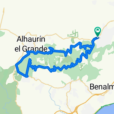
El Peñon-Sierra Llana-Churriana
A cycling route starting in Alhaurín de la Torre, Andalusia, Spain.
Overview
About this route
- -:--
- Duration
- 23.3 km
- Distance
- 344 m
- Ascent
- 336 m
- Descent
- ---
- Avg. speed
- 302 m
- Max. altitude
Route quality
Waytypes & surfaces along the route
Waytypes
Quiet road
10.7 km
(46 %)
Busy road
5.5 km
(24 %)
Surfaces
Paved
11.6 km
(50 %)
Asphalt
6.1 km
(26 %)
Paved (undefined)
5.4 km
(23 %)
Undefined
11.7 km
(50 %)
Continue with Bikemap
Use, edit, or download this cycling route
You would like to ride El Peñon-Sierra Llana-Churriana or customize it for your own trip? Here is what you can do with this Bikemap route:
Free features
- Save this route as favorite or in collections
- Copy & plan your own version of this route
- Sync your route with Garmin or Wahoo
Premium features
Free trial for 3 days, or one-time payment. More about Bikemap Premium.
- Navigate this route on iOS & Android
- Export a GPX / KML file of this route
- Create your custom printout (try it for free)
- Download this route for offline navigation
Discover more Premium features.
Get Bikemap PremiumFrom our community
Other popular routes starting in Alhaurín de la Torre
- El Peñon-Sierra Llana-Churriana
- Distance
- 23.3 km
- Ascent
- 344 m
- Descent
- 336 m
- Location
- Alhaurín de la Torre, Andalusia, Spain
- ZAPATA VILLAFRANCO
- Distance
- 23.7 km
- Ascent
- 275 m
- Descent
- 243 m
- Location
- Alhaurín de la Torre, Andalusia, Spain
- 3ª Eta Alhaurín el grande . Las casas de Vistavela
- Distance
- 177.8 km
- Ascent
- 1,837 m
- Descent
- 1,335 m
- Location
- Alhaurín de la Torre, Andalusia, Spain
- Alhaurín de la Torre - Puerto de la Torre
- Distance
- 9.1 km
- Ascent
- 548 m
- Descent
- 549 m
- Location
- Alhaurín de la Torre, Andalusia, Spain
- Alhaurin-ermita cartama-jarapalos
- Distance
- 44 km
- Ascent
- 1,051 m
- Descent
- 1,051 m
- Location
- Alhaurín de la Torre, Andalusia, Spain
- Zapata - Coín - Cártama - Zapata
- Distance
- 47.7 km
- Ascent
- 322 m
- Descent
- 322 m
- Location
- Alhaurín de la Torre, Andalusia, Spain
- Circular canteras-jabalcuza alhaurin de la torre
- Distance
- 12.7 km
- Ascent
- 538 m
- Descent
- 538 m
- Location
- Alhaurín de la Torre, Andalusia, Spain
- 1ª Marcha Cicloturista Alhaurín de la Torre - Alhaurín de la Torre 128 km
- Distance
- 129.2 km
- Ascent
- 1,097 m
- Descent
- 1,097 m
- Location
- Alhaurín de la Torre, Andalusia, Spain
Open it in the app