

Argenton s Cr. - L.O.W
A cycling route starting in Argenton-sur-Creuse, Centre-Val de Loire, France.
Overview
About this route
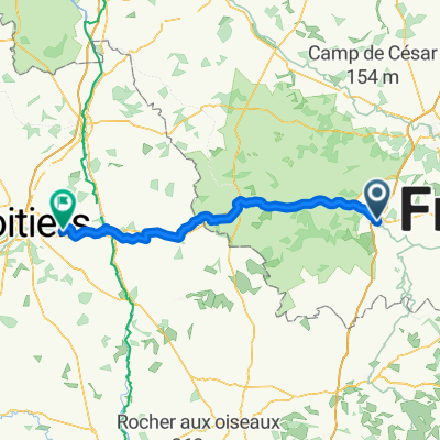
Station - La Chaumerette campsite - Chaps de Roches - D30
- -:--
- Duration
- 26.9 km
- Distance
- 407 m
- Ascent
- 265 m
- Descent
- ---
- Avg. speed
- ---
- Max. altitude

Route quality
Waytypes & surfaces along the route
Waytypes
Quiet road
11 km
(41 %)
Road
4 km
(15 %)
Surfaces
Paved
0.5 km
(2 %)
Unpaved
1.6 km
(6 %)
Unpaved (undefined)
1.6 km
(6 %)
Asphalt
0.5 km
(2 %)
Undefined
24.7 km
(92 %)
Continue with Bikemap
Use, edit, or download this cycling route
You would like to ride Argenton s Cr. - L.O.W or customize it for your own trip? Here is what you can do with this Bikemap route:
Free features
- Save this route as favorite or in collections
- Copy & plan your own version of this route
- Sync your route with Garmin or Wahoo
Premium features
Free trial for 3 days, or one-time payment. More about Bikemap Premium.
- Navigate this route on iOS & Android
- Export a GPX / KML file of this route
- Create your custom printout (try it for free)
- Download this route for offline navigation
Discover more Premium features.
Get Bikemap PremiumFrom our community
Other popular routes starting in Argenton-sur-Creuse
 2019_E3_Argenton sur creuse-La souterraine
- Distance
- 57.8 km
- Ascent
- 617 m
- Descent
- 319 m
- Location
- Argenton-sur-Creuse, Centre-Val de Loire, France
 2013-14: Argenton-sur-Creuse > Cusset (188 km)
- Distance
- 187.8 km
- Ascent
- 1,104 m
- Descent
- 964 m
- Location
- Argenton-sur-Creuse, Centre-Val de Loire, France
 argenton sur creuse 4 etapes
- Distance
- 2.3 km
- Ascent
- 16 m
- Descent
- 17 m
- Location
- Argenton-sur-Creuse, Centre-Val de Loire, France
 Argenton/Creuse - Vienne-en-Val
- Distance
- 156.3 km
- Ascent
- 347 m
- Descent
- 353 m
- Location
- Argenton-sur-Creuse, Centre-Val de Loire, France
 Rue Rosette 17, Argenton-sur-Creuse nach Allée du Broutet 20, Le Pont-Chrétien-Chabenet
- Distance
- 6.3 km
- Ascent
- 53 m
- Descent
- 46 m
- Location
- Argenton-sur-Creuse, Centre-Val de Loire, France
 Argenton s Cr. - L.O.W
- Distance
- 26.9 km
- Ascent
- 407 m
- Descent
- 265 m
- Location
- Argenton-sur-Creuse, Centre-Val de Loire, France
 Argenton-sur-Creuse - Sèvres-Anxaumont
- Distance
- 99.2 km
- Ascent
- 515 m
- Descent
- 508 m
- Location
- Argenton-sur-Creuse, Centre-Val de Loire, France
 argenton-preuilly
- Distance
- 73.1 km
- Ascent
- 256 m
- Descent
- 270 m
- Location
- Argenton-sur-Creuse, Centre-Val de Loire, France
Open it in the app